
Loading…

MapGES2

Characterization of deep-sea habitats, for its mapping up to the outer limit of the Azores sub-area of the Portuguese Exclusive Economic Zone

MapGES2

Loading project…

Characterization of deep-sea habitats, for its mapping up to the outer limit of the Azores sub-area of the Portuguese Exclusive Economic Zone

Period: 01 Feb 2023 to 31 Dec 2026

Funding: 1 source(s)

AZORES DEEP-SEA RESEARCH
Time period

01 Feb 2023 to 31 Dec 2026


Funding
Regional 18/DRPM/2022, ACORES-14-62G4-FEDER-000001

Regional Government of the Azores, EU, ACORES-14-62G4-FEDER-000001, PO Açores 2020, REACT-EU, ERDF

Budget: 2,645,000.00 €

Summary

Characterization of deep-sea habitats, for its mapping up to the outer limit of the Azores sub-area of the Portuguese Exclusive Economic Zone

This contract aimed to produce a detailed compilation of the best existing information on the biodiversity of the deep sea of the Azores and its spatial distribution down to 1,000 m depth, namely in what regards to: VME indicator species, location of known biological communities, inventory and description of habitats identified in the Azores, and known spatial distribution of habitats up to the outer limit of the Azores subarea of the Portuguese EEZ.

It also aimed to present recommendations for the protection of these ecosystems and obtaining or maintaining their good environmental status, in accordance with the requirements of the Marine Strategy Framework Directive. Finally, it performed an assessment of the pressures and threats from human activities in the deep-sea at sea with the potential to affect these ecosystems.

After the first expeditions to the deep sea in the late 19th and early 20th centuries lead by Prince Albert I of Monaco, extensive scientific research based in the Azores has opened a window on the functioning of large deep-sea ecosystems and the impacts of human activities in such ecosystem. The Azores have, therefore, a long history of deep-sea research, recently supported by various regional, national, and European funded research projects and international collaborations. This research consolidated the knowledge about seamounts, ridges, and hydrothermal vent ecosystems at the global and local scales. Despite all these efforts, substantial gaps in scientific knowledge still exist that may hamper the implementation of marine environmental policies in the Region. Indeed, the Regional Directorate for Maritime Policies (DRPM), considered necessary to fill the knowledge gaps regarding the characterization of the deep sea in the Azores through the inventory and characterization of deep-sea habitats as well as vulnerable marine ecosystems (VMEs).

Show less ↑
Show more ↓

Our Team's role

Azores Deep-sea Research

Coordination of the whole project, including field and lab work, reports, and deliverables
Involved team members

Telmo Morato

Coordinator

Marina Carreiro-Silva

WP leader
Carlos Dominguez-Carrió

WP leader
Filipe M. Porteiro

WP leader
Luís Rodrigues

WP leader
Laurence Fauconnet

Scientist
Teresa Cerqueira

Early-career researcher
Marisa Gomes

Research Assistant

Alvise Dabalà

Research Assistant
António Godinho

Research Assistant
Gabriela Cardoso

Research Assistant
Inês Carneiro

Research Assistant
Inês Correia Bruno

Research Assistant
Isabel Areosa

Research Assistant
João Balsa

Research Assistant
João Pontes

Research Assistant
Marc Pladevall

Research Assistant
Marina Navarro Engesser

Research Assistant
Rachel Lacoste

Research Assistant
Sérgio Gomes

Research Assistant

Valter Medeiros

Research Assistant
Gal·la Edery

Research Assistant
Guilherme Gonçalves

Research Assistant
Manuela Ramos

Research Assistant
Gerald Hechter Taranto

PhD Student

Collaborators

Nicolás Collazo
Diana Catarino
Alexandra Rosa
Alexandre Morais

Accomplished missions

Main results

The data compiled and obtained during this project contributed to filling identified knowledge gaps on the characterization of the deep-sea marine biodiversity (<1,000 m depth) until the outer limit of the Azores sub-area of the Portuguese EEZ, in terms of species, communities and habitats present there. The project contributed to a better definition of deep-sea habitat typologies, including the definition of Vulnerable Marine Ecosystems. A key aspect was mapping the spatial distribution of deep-sea species, communities and habitats until the outer limit of the Azores sub-area of the Portuguese EEZ and the identification of areas that fit the definition of VMEs in the Azores. The project also supported information that enables national and international reporting, regarding environmental policies for the marine environment, by the Autonomous Region of the Azores. Finally, we demonstrated and tested low-cost tools to support monitoring the environmental status of the deep sea, up to the outer limit of the Azores sub-area of the Portuguese EEZ.

  1. Existing datasets: After the exhaustive compilation of data on the deep-sea biodiversity of the Azores down to 1,000 m depth we produced georeferenced database with the respective metadata, following the interoperability recommendations of regional authorities, as well as international harmonization standards. On November 1st 2023, the database compiled contained 60,877 (taxa) plus 1,683 (communities) records of marine biodiversity in the deep sea of the Azores with an emphasis on rates that indicate the presence of VME.
  2. Integrative taxonomic approach: Using an integrative taxonomic approach, we have examined 52 specimens across 18 taxa of cold-water corals. This work generated 94 new DNA barcoding consensus sequences (average length 700 bp), and a genome skimming dataset with 9M PE reads per specimen. For the first time a genomic study that combined high-throughput sequencing data from cold-water corals sampled on different sites of the North Atlantic and the Azores was conducted, applying a phylogenomic approach that included 445 taxa. Using this dataset together with diagnosing morphological characters, we have attributed names to seven morphotypes (corals belonging to Paramuriceidae, Keratoisididae, Alcyoniidae) and identified several putative new species. The taxonomic examination of Porifera specimens from COLETA and OceanX 2023 greatly increased the knowledge of the sponge diversity of the Azorean Region, which to date represented a poorly studied group. From a total of 52 analised specimens, 36 species were assigned. Four putative new species and one genus were identified.
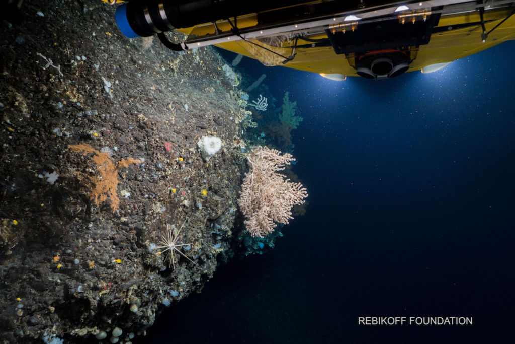
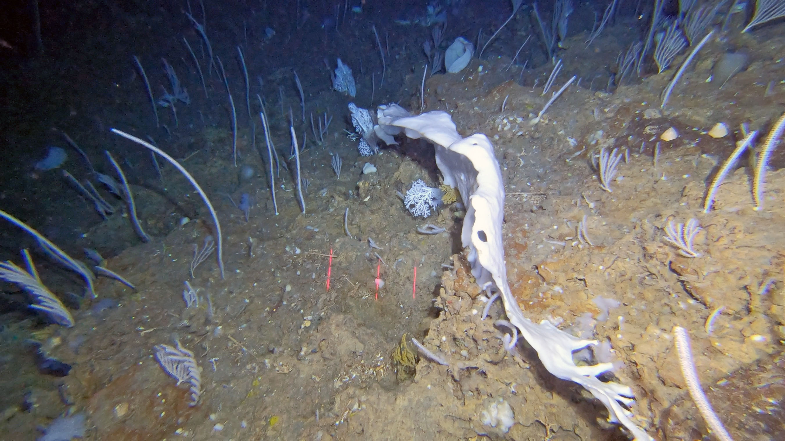
  3. VME indicator species: The reassessment of the total diversity of cold-water corals in the Azores based on the new information generated accounts for +190 species. This list is likely to grow in the future with increasing deep-sea sampling effort from ROV expeditions. The diversity of sponges in the Azores is reported to be high however this group is little studied. Evaluation of potential VME indicator species identified 27 Octocorallia, 9 Scleractinia, 6 black corals, 3 Stylasterids, and thirteen sponge taxa.
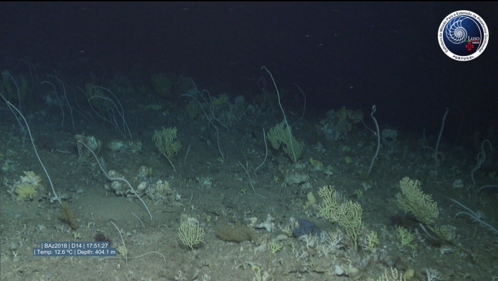
  4. VME indicator biological communities: Through visual assessments, 39 associations of conspicuous benthic species have now been identified and catalogued, providing in each case the main structuring taxa (i.e., indicator species). The vast majority of benthic communities identified so far can be included under the category of coral gardens (n= 23), not undervaluing those classified as sponge grounds (n= 9), coral reefs (n= 2), Xenophyophore aggregations (n= 1) and those formed by other taxa (n= 4). From the 39 benthic communities identified from the video images, 25 were considered to fit the criteria for Vulnerable Marine Communities (VMCs).
  5. Spatial distributions of deep-sea biological diversity on geomorphological features: The existing underwater video transects down to 1,000 m span the whole EEZ, with 69 in Western Group of the Azores, 49 in the Northern Mid-Atlantic Ridge, 103 in the central Mid-Atlantic Ridge, 47 in the Southern Mid-Atlantic Ridge, 295 in the Northern Central Group of the Azores, 392 in the Southern Central Group of the Azores, and 193 in the Eastern Group of the Azores, and 34 outside the EEZ but in areas of interest. Video footage and annotations have been obtained for all 140 L3 areas. As of 1st November 2023, the database generated from the annotation of the benthic megafauna contains 52,697 records inside of the Azores EEZ. Each of these records corresponds to the occurrence of one OTU in segments of 100 m along each dive, providing an estimated density value using the coding of the SACFOR scale. This database is now a fundamental tool for mapping the distribution of biodiversity and VME indicator taxa within the limits of the Azores EEZ.
  6. Vulnerable Marine Ecosystems: We evaluated the 140 geomorphological structures of the Azores in relation to each of the five FAO criteria to define what constitutes a VME, based on the information compiled, collected and analysed during this project. The evaluation was based on the species and communities found in each geomorphological structure as well as a measure of their abundance. The assessment of underwater features against the VME criteria identified 41 out of the 140 areas that could fit the criteria that defines a VME.
  7. Evaluating of Descriptor 6: To support the assessments of the Descriptor 6 criteria (D6C3 and D6C5), we carried out an assessment of the degree of pressure and threat relating to human activities. We adopted a standard methodology for this purpose which starts from the characterization and mapping of conservation values and pressures arising from activities and potential uses. We also developed matrices of pressures and threats that allow an objective assessment of impacts and contribute to the assessment of D6C3 and D6C5. The application of the VME and fishing effort portfolio categories identified 22 areas classified as VME that fall in the portfolio category high VME – low VMS, 14 falling in the portfolio category high VME – high VMS, and 3 in the other category. The areas where high fishing effort overlaps with high VME index may be areas of potentially significant adverse impacts in vulnerable marine ecosystems.
Show less ↑
Show more ↓
MapGES 2023 cruise report: Exploration and mapping of deep-sea biodiversity in the Azores on board the MT Physeter
Zenodo
|
Oct, 2023
15 team members are authors
OA DOI 10.5281/ZENODO.10787942
Abstract
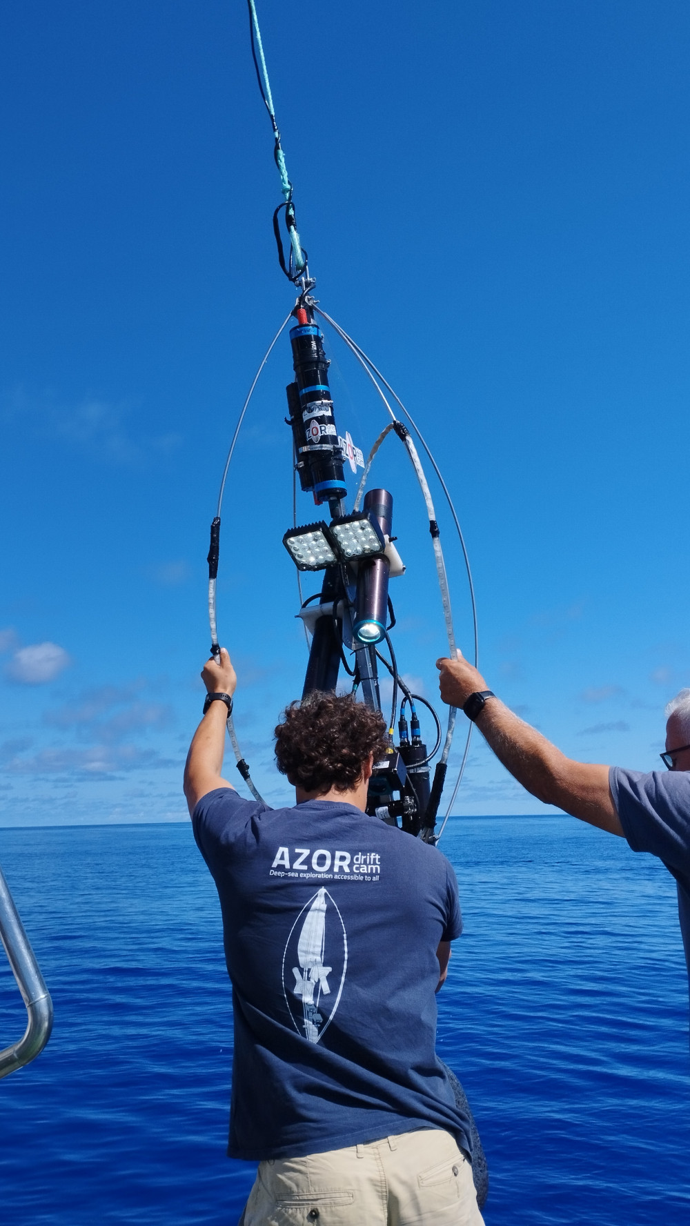
Main objective: MapGES 2023 is the continuation of our long-term strategy to map deep-sea biodiversity and identify Vulnerable Marine Ecosystems (VMEs) in the Azores using the Azor drift-cam imagery system. As in other MapGES cruises, the objectives were to (i) map benthic communities inhabiting unexplored seamounts, ridges, and island slopes, (ii) identify new areas that fit the FAO Vulnerable Marine Ecosystem definition; and (iii) determine distribution patterns of deep-sea benthic biodiversity in the Azores. The results of this cruise added to the previous contributions to identify the environmental drivers that determine the spatial distribution of deep-sea benthic biodiversity in the Azores. It also provides valuable information in the context of Good Environmental Status (GES), Marine Spatial Planning (MSP) and new insights on how to sustainably manage deep-sea ecosystems. Methodology: We performed several underwater video transects along the seafloor with the Azor drift-cam, a low-cost drifting camera system designed and developed at IMAR & Okeanos (University of the Azores), which allows the recording of high-quality underwater video images of the seabed down to 1000 m depth. The system was deployed from the research vessel RV Arquipélago, owned by the Government of the Azores. Cruise summary: The MapGES 2023 MT Physeter cruise was composed of two parts divided into 5 Legs. In the first part, we visited some unexplored areas such as the geomorphological structures Boureé NE (previously named Açor NW), Açor bank, de Guerne N (previously named Açor SE), São Mateus de Fora, Agulhas das 18 Milhas, Álvaro Martins seamount, Terceira N, Terceira S, Terceira E, Maçarico, Beirada de fora (previously part of Maçarico) and Gastromar. In the second, we also visited some unexplored areas such as the geomorphological structures around the islands of São Jorge (São Jorge E Topo e São Jorge NE) and of São Miguel (São Miguel N, NE, E, SE, S, SW, O, NO, e Mar da Prata Norte), and we revisited other geomorphological structures that needed complementary sampling efforts as, for example, São Jorge SE, e São Jorge S Urzelina. During the MapGES 2023 MT Physter cruise, we performed 204 dives in 212 stations down to 1 000 m depth, and covered about 124 km of seafloor, resulting in more than 211 hours of video imagens. These dives were conducted in 32 different sampling areas, including 11 seamounts and 21 island slopes around the islands of Terceira, São Miguel, and São Jorge. During this cruise, we explored, for the first time, the deep-sea benthic communities inhabiting banks, ridges, seamounts, and slopes located around the Island of São Miguel. Main achievements: 1. We visited thirty-two unexplored geomorphological structures in the Azores EEZ listed in the evaluation of areas with substantial knowledge gaps a. Part 1 (Legs 1, 2, and 3) –geomorphological structures south of Faial and around Pico Islands Boureé NE (Açor NW), Açor, de Guerne N (Açor SE), São Mateus de Fora, Agulhas 18 Milhas; and 6 new areas around Terceira - Álvaro Martins, Terceira N, Terceira S, Terceira E, Maçarico, Gastromar, Beirada de fora. We also visited some areas that have already been explored but needed extra video data, namely Terceira NE and Pico N. We also explored a completely new area named 12 Milhas. b. Part 2 (Legs 4 and 5) – São Jorge E Topo, São Miguel N, NE, E, SE, S, SW, O, NO, e Mar da Prata Norte. We managed to fill some knowledge gaps about the benthic communities located in the southeast and eastern portions of São Jorge Island (São Jorge SE and S Urzelina), an area that was difficult to access and explore from small vessels like the MT Physeter, which we did not have the opportunity to visit in previous campaigns. 2. During Leg 1 MapGES 2023 MT Physeter cruise we explored particularly sensitive areas due to fishing activities, namely south of Faial and Pico islands. As in previous years, the presence of some fishing lines made our deep-sea exploration challenging. After having the Azor drift-cam caught on several lines, we managed to get free with only minor damages. This collateral fishing impact is preventing the acquisition of deep-sea biodiversity data to inform management and deserve to be better quantified. Problems with the Outland laser systems resulted in the lack of laser points in some of the images recorded. 3. In both Leg1 and Leg 2 of MapGES 2023 Physeter cruise, most of the dives performed covered sections of sedimentary bottoms, usually characterized by low levels of biodiversity. Nevertheless, some extensive aggregations of the primnoid corals Narella versluysi and Narella bellissima were occasionally observed colonizing rocky outcrops. The bird’s nest sponge Pheronema carpenteri, together with Asconema fristedti composed most of the sponge assemblage, covering areas of mixed substrate. In MapGES 2023 Physeter cruise Leg2, a particularly surprising highlight, since we were completely unaware of this throughout the dive itself, was the impressive aggregation of the echinoderm Cidaris cidaris. It covered a vast section of flat sedimentary seafloor, being the largest and densest aggregation we have recorded so far in the Azores region. 4. The abundance, diversity, and condition in which the several benthic communities observed were found thriving on the Terceira island’s slopes was particularly special and definitely a highlight of Leg3. Despite these previously unexplored areas being subjected to considerable degrees of fishing effort, most of the benthic fauna observed was visually healthy and harboured many associated fish species as well. The main highlights of Leg 3 were: (1) the sighting of uncommonly large specimens of the coral Dentomuricea aff. Meteor in Terceira N, quite possibly the largest specimens we have recorded so far in the Azores region; (2) The detection of areas with the display of black coral aggregations such as Leiopathes glaberrima and L. expansa; (3) Observation of what we believe are small primnoid corals yet to be identified in at least two different seamounts in Terceira E area. 5. During Leg 4, it was the first time an extensive scientific survey was specifically designed to map and describe deep-sea benthic communities inhabiting banks, ridges, seamounts, and slopes located around the Island of São Miguel. 6. In both Legs 4 and 5 of MapGES 2023, most of the dives performed covered sections of sedimentary bottoms, usually characterized by low levels of biodiversity. Nevertheless, there were locations showing extensive coral aggregations that potentially are indicative of Vulnerable Marine Ecosystems. These aggregations were mostly encountered at depths shallower than 400-500 m depth and were dominated by extraordinarily large colonies of Callogorgia verticillata and, less frequently, by colonies of Dentomuricea aff. meteor often mixed with other coral species commonly found around the Azores, such as Viminella flagellum and Acanthogorgia spp. On a few occasions, extensive aggregations of the primnoid corals Narella versluysi and Narella bellissima were observed at depths greater than 500 m. 7. Noteworthy is the observation, during Leg 5, of some coral aggregations that appear to be particularly rare in the archipelago of the Azores. These include (i) a vast area completely covered by a reef of the stony coral Eguchipsammia cornucopia; (ii) an extraordinarily dense coral garden featuring, among other species, the bubble gum coral Paragorgia johnsoni (a species that do not appear to be very common on island slopes), and particularly high densities of the primnoid species Narella bellissima and N. versluysi; (iii) a large area dominated by an unidentified species of the family Stylasteridae (i.e. lace corals); (iv) an area dominated by a rare purple coral most likely of the genus Paramuricea; (v) an aggregation of black corals (order Antipatharia) on the northern part of Mar da Prata Bank. 8. Regarding sponge aggregations, the highlights of these two legs are (i) the observation of extensive areas with the presence of the species Pseudotrachya hystrix, mainly encountered at the common sandy floors where we usually drifted over, (ii) some frequent sightings of even bigger specimens of the often-robust Characella pachastrelloides complex and, (iii) the frequent notice of big and widespread aggregations of the “bird nest” sponge, Pheronema carpenteri. 9. A potential new species of deep-sea fish may have been observed for the first time in the Azores archipelago, named Gaidropsaurus spp., spotted on two different days. 10. The invasive alga Rugulopteryx okamurae, which in recent years appeared on most Azorean shores, was very frequently observed in large patches down to depths of about 900 m, suggesting that the impact of this species on resident communities may not only be limited to coastal areas but also extend into the deep sea of the Azores. Therefore, to fully understand how Rugulopteryx okamurae alters the distributional and niche dynamics of native species and the extent of its impacts, there is a need to investigate how it affects both shallow and deep-sea communities. 11. In general, it was found that the benthic communities around São Miguel Island present an apparent good environmental status. This observation is particularly relevant if we consider that this area concentrates a significant part of the bottom fishing effort in the Azores Region. 12. During Leg2 of this cruise, we achieved a long waiting milestone: teaching our South Atlantic partners how to operate the Azor drift-cam. The iAtlantic capacity building workshop aimed to share the technological and methodological details for the use of the Azor drift-cam. It ran from 5-8th June 2023 in the facilities of Escola do Mar (EMA) in the city of Horta (Faial Island, Portugal). A total of 12 researchers from the iAtlantic consortium
MapGES 2024 cruise report: Exploration and mapping of deep-sea biodiversity in the Azores on board the MT Physeter
Zenodo
|
Oct, 2024
15 team members are authors
OA DOI 10.5281/ZENODO.14181251
Abstract
Main objective: MapGES 2024 continues our longstanding commitment to map deep-sea biodiversity and identifying Vulnerable Marine Ecosystems (VMEs) in the Azores with the Azor drift-cam imagery system. Our 2024 expedition aimed to enhance the data collected in previous surveys by conducting new video transects along the slopes of several islands in the archipelago, including São Miguel and the northern Mar da Prata, Graciosa, Ponta da Ilha N in the Southeast of Pico Island, as well as Flores, Corvo, and Terceira Islands. This fieldwork focused on under-sampled areas and deeper strata. Additionally, we planned to explore two new areas, specifically Ilha Azul W and Raio Seamount. Our ultimate goal is to achieve a comprehensive understanding of the deep-sea fauna dwelling on the slopes, banks, and seamounts in these areas. Like previous MapGES cruises, our objectives included: (i) mapping benthic communities in previously unexplored seamounts, ridges, and island slopes; (ii) identifying new areas that meet the FAO definition of Vulnerable Marine Ecosystems; and (iii) determining the distribution patterns of deep-sea benthic biodiversity in the Azores. The results of this cruise added to the previous contributions to identify the environmental drivers that determine the spatial distribution of deep-sea benthic biodiversity in the Azores. It also provides valuable information in the context of Good Environmental Status (GES), Marine Spatial Planning (MSP) and new insights on how to sustainably manage deep-sea ecosystem. Methodology: We conducted several underwater video transects along the seafloor using the Azor drift-cam, a cost-effective drifting camera system developed by IMAR and Okeanos at the University of the Azores. This system is capable of recording high-quality underwater video images of the seabed down to 1000 m depth, and it was deployed from the MT Physeter. Cruise summary: The MapGES 2024 cruise aboard MT Physeter consisted of 4 legs aimed at exploring and revisiting slopes, banks, ridges, and seamounts surrounding São Miguel, Graciosa, Pico, Flores, Corvo, and Terceira Islands. A total of 150 successful dives were conducted out of 153 planned, covering 28 sampling areas and approximately 80km of the seafloor and generated more than 150 hours of video footage for analysis. During Leg 1, from 30th June to 17th July 2024, we performed 40 successful dives with the Azor drift-cam. This first Leg surveyed the deep-sea benthic communities dwelling on the slopes of the geomorphological structures around São Miguel Island and the north part of the Mar da Prata seamount. This was a challenging leg due to the bad weather conditions throughout the mission. During the Leg 2, from 21st July to 1st August 2024, we performed 48 successful dives with the Azor drift-cam around Graciosa Island slopes and some adjacent geomorphological structures such as Ilha Azul and Mar da Fortuna. We also revisited the south of Pico Island namely the northernmost part of a seamount chain area called Ponta da Ilha. The explorations of the Ponta da Ilha N was unexpectedly challenging due to its geomorphology, being even more difficult when operating with a small vessel such as MT Physeter. During Leg 3, from 9th to 22sd August 2024, we performed 43 dives in the island slopes around Flores and Corvo. During Leg 4, from 26th August to 7th September we performed a total of 22 dives with the Azor drift-cam, a little less than the usual number because of the constant bad sea conditions. Nevertheless, we were able to revisit the Terceira Island slopes and the adjacent banks and seamounts. Main achievements: During the MapGES 2024 survey conducted aboard the MT Physeter, 153 stations were completed using the Azor drift-cam. The stations spanned depths ranging from 100 to 1130 m, encompassing a broad spectrum of marine strata. The survey covered approximately 80km of the seafloor and generated more than 150 hours of video footage for analysis. These numbers represent a big achievement considering that (i) we successfully operated, once again, the Azor drift-cam for deep-sea exploration on board a small vessel and (ii) a great part of the days at the sea were characterized by an extremely challenging weather, especially during Leg 1 and 4 around São Miguel and Terceira Islands. This year’s survey included a diverse set of locations, involving Ilha Azul, Raio seamount, and the northern extension of the Ponta da Ilha volcano chain. This volcanic structure, extending nearly 40 nautical miles from the eastern tip of Pico Island, is still just slightly explored due to the time and vessel limitations and definitely deserves a more in-depth exploration. Due to its particular geomorphology, which is made up of a chain of many narrow seamounts, deploying the Azor drift-cam and passing over the top of the seamounts was a very difficult task, as most of the time the structure only passed along one flank of the hill. For the second consecutive year of the MapGES survey on-board the MT Physeter, no entire Azor drift-cam structures were irretrievably lost despite entanglements with discarded fishing lines or contact with big basaltic outcrops. The successful retrieval of all deployed gear, with only minor damage during all the campaign, underscores the team’s preparedness and their effective response to challenging situations. The MapGES 2024 survey was substantially focused on investigating deeper strata in areas already visited during the previous campaigns. Exploration of these deeper zones provided a more comprehensive understanding of deep-sea biodiversity, so that we can manage to fill some knowledge gaps about the benthic communities present in some of the areas. Several rare or less frequently encountered species were observed using the Azor drift-cam, notablyincluding swordfish (Xiphias gladius), the European spiny lobster (Palinurus elephas), the smalltooth sandtiger shark (Odontaspis ferox), and a species of sponge tentatively identified as cf. Hertwigia falcifera. Wealso had the opportunity to record two different species belonging to the genus Halosaurus, being this fact notable because it was only recorded for the first time with the Azor drift-cam during MapGES 2023 survey. Although no particularly large or spectacular coral communities were detected, several diverse coralgardens were identified, particularly around Terceira Island. These included notable gorgonian species such as Dentomuricea aff. meteor, Acanthogorgia spp., Viminella flagellum, and Paracalyptrophora josephinae. Outstanding coral gardens dominated by the octocoral Dentomuricea aff. meteor had been reported during the MapGES 2023 survey around Terceira Island, and this year, revisiting nearby areas, it wasn’t possible to observe exemplars as a large as last year, probably mainly due to explorations at deeper sectors. During this year campaign, when in São Miguel, we were able to witness what it could be one of the most extensive and with the largest individuals of the gorgonian Candidella cf. imbricata ever recorded with the Azor drift-cam. These aggregations were sighted on Mar da Prata N, and the observation is particularly relevant because of the apparently good coral status and because this area is strongly known for the concentration of significant part of the bottom fishing effort in the Azores region. We detected an extraordinary aggregation of the “bird’s nest” sponge Pheronema carpenteri in Ponta daIlha N (Southeast of Pico Island). There is a high chance that this is one of the densest and largest fieldsmainly composed by this sponge, that we have recorded with the Azor-drift cam, growing on a large flatarea characterized by soft and unconsolidated substrate. This reinforces the idea that this is most certainly the sponge species we encounter most frequently and in higher densities, across a relatively large depth range.
MapGES 2023 cruise report: Exploration and mapping of deep-sea biodiversity in the Azores on board the RV Arquipélago
Zenodo
|
Oct, 2023
15 team members are authors
OA DOI 10.5281/ZENODO.10785022
Abstract
Main objective: MapGES 2023 is the continuation of our long-term strategy to map deep-sea biodiversity and identify Vulnerable Marine Ecosystems (VMEs) in the Azores using the Azor drift-cam imagery system. As in other MapGES cruises, the objectives were to (i) map benthic communities inhabiting unexplored seamounts, ridges, and island slopes, (ii) identify new areas that fit the FAO Vulnerable Marine Ecosystem definition; and (iii) determine distribution patterns of deep-sea benthic biodiversity in the Azores. The results of this cruise added to the previous contributions to identify the environmental drivers that determine the spatial distribution of deep-sea benthic biodiversity in the Azores. It also provides valuable information in the context of Good Environmental Status (GES), Marine Spatial Planning (MSP) and new insights on how to sustainably manage deep-sea ecosystems. Methodology: We performed several underwater video transects along the seafloor with the Azor drift-cam, a low-cost drifting camera system designed and developed at IMAR & Okeanos (University of the Azores), which allows the recording of high-quality underwater video images of the seabed down to 1000 m depth. The system was deployed from the research vessel RV Arquipélago, owned by the Government of the Azores. Cruise summary: The MapGES 2023 RV Arquipélago cruise was composed of two Legs. In the first, we visited some unexplored areas such as the geomorphological structures around the Princesa Alice bank and the seamounts north of Graciosa (Sedlo, Borda, João Leonardes, and Gaillard) (central Azores). In the second, we also visited some unexplored areas such as the geomorphological structures of Hard Rock Café (northern of Corvo Island), Kurchatov SE (in the north mid Atlantic-ridge), Albatroz N, Ferraria N, Ferraria Mar, Sauerwein, Mar da Prata, Grande Norte (south of Faial Island), and the seamounts around Princesa Alice (Princesa Alice S, Princesa Alice SE, and De Guerne) and we revisited other geomorphological structures that needed complementary sampling efforts as, for example, Isolado, Kurchatov N, Kurchatov SW, and Mar da Prata South. During the MapGES 2023 RV Arquipélago cruise, we performed 145 dives in 148 stations down to 1 125 m depth, and covered about 85 km of seafloor, resulting in more than 141 hours of video images. These dives were conducted in 28 different sampling areas, including 26 seamounts and 2 island slopes around the island of São Jorge. During this cruise, we explored, for the first time, some areas such as the famous Hard Rock-Café and Sedlo seamounts. Data on the benthic communities inhabiting these seamounts was lacking to complement existing information that supported the designation of these areas as Marine Protected Areas (MPA) of the Azores Marine Park (PMA). Main achievements: 1. Eighteen unexplored geomorphological structures in the Azores EEZ were visited, being listed in the evaluation of areas with substantial knowledge gaps. a. Leg1 – Sedlo W, Sedlo, Borda, São Jorge NE, Princesa Alice W (formerly part of Princesa Alice), Princesa Alice SW (formerly Alberto do Mónaco), Picos S do Princesa Alice-, plus two areas that were not listed - the Gaillard seamount and the an area West of Picos S do Princesa Alice. We also visited some areas that have already been explored but were in need of extra video data namely João Leonardes, Serreta Mar, Mar da Fortuna, and São Jorge NW. b. Leg 2 – Hard Rock Café, Kurchatov SE, Albatroz N, Ferraria N, Ferraria Mar, Sauerwein, Mar da Prata, Mar da Prata N, Grande Norte and one seamount around Princesa Alice (De Guerne). We also visited four areas that have already been explored but needed extra video data namely the Isolado, Kurchatov N, Kurchatov SW, and Mar da Prata S. We also visited the Perestrelo Bartolomeu area, for which some information already existed, and the Petrov area, which turned out to be deeper than what the maps indicated. 2. During the MapGES 2023 cruise we accomplished 143 underwater video transects and the deepest dive to date performed with the Azor drift-cam, at 1 125 m depth. In total, we collected 141 hours of new underwater video footage of seabed habitats. As in previous years, the presence of some fishing lines made our deep-sea exploration challenging. After having the Azor drift-cam caught on several lines, mainly around São Miguel Island (Mar da Prata and Grande Norte seamount) and Kurchatov SE, we managed to get it free only with minor damages. This collateral fishing impact is hampering the acquisition of deep-sea biodiversity data to inform management deserve to be better quantified. Problems with the Outland lasers systems resulted in the lack of laser points the some of the images recorded. 3. We finally explored the Sedlo seamount with the Azor drift-cam. From 2002–2005, Sedlo was the focus of a multidisciplinary EU project, OASIS (Oceanic Seamounts: An Integrated Study), which showed highly complex hydrographical patterns with anticyclonic circulation around its three summits, driven principally by Taylor column formation. This seamount was speculated to accommodate one the Azores’ most important spawning ground for orange roughies and alfonsinos. 4. Deep-sea explorations with the Azor drift-cam contributed with supporting evidence to consider Sedlo seamount as an Essential Fish Habitat. We found areas that are home to the highly endangered deep-sea fish orange roughy Hoplostethus atlanticus and discovered that Sedlo and other neighbouring seamounts host a high number of deep-sea shark species, some of which rarely observed in the Azores. We also discovered large aggregations of the black coral Leiopathes expansa on the summit of the Sedlo W, with most specimens of relatively small sizes. This area seemed to be a good candidate for being considered a Vulnerable Marine Ecosystem and should be kept in the list of priority areas for conservation in the Azores. 5. We also explored Borda, João Leonardes, Gaillard seamount, north of Graciosa Island. Along with Sedlo, these seamounts seem to host slightly unique deep-sea benthic communities when compared to other areas in the Azores EEZ explored so far with black corals Leiopathes expansa and Parantipathes hirondelle, the bamboo coral Acanella arbuscula, stylasterids of the genus Errina, the sea urchin Cidaris cidaris, and lamellate sponges of the genus Phakellia among others 6. We started exploring the morphological features south of Princesa Alice peak. Most dives covered soft and mix sediments with relatively low biodiversity and abundance, although some areas hosted high densities of Narella bellissima and Narella versluysi, while others were dominated by patches of Pheronema carpenteri and other sponges (e.g., Asconema sp.). We also observed some sparse colonies of cold-water such as corals Narella versluysi, Hemicorallium niobe, H. tricolor, Acanella arbuscula, Chrysogorgya sp., cf. Leptopsammia, cf. Candidella imbricata, and Flabellum sp., and some deep-sea sponges such as cf. Regadrella, and specimens from the genus Geodia, along with some shrimps Aristaeopsis edwardsiana, sea-urchins Cidaris cidaris and deep-sea fishes such as Mora moro, Synaphobranchus kaupii, Helicolenus dactylopterus, Hoplostethus mediterraneus, Gephyroberix darwinii, Dalatias licha, and one Trachyscorpia cristulata. 7. The Hard Rock Café seamount was finally explored with the Azor drift-cam. The hydrographic Institute had mapped this seamount in 2020 but given its location at 210 nautical miles from the natural starting point of the MapGES cruises (Horta) and its position to the north of the Azores archipelago (usually more affected by adverse weather conditions), the visit to this seamount had been postponed for a few years. After all conditions were met, the Hard Rock Café was visited. It is a geomorphological structure that, due to its characteristics, was from the first moment on the list of the first options for the expansion of the Azores Marine Park, hence the increased importance of this visit. 8. We also visited a seamount named Petrov. This area does not yet have high-resolution bathymetry data, so we tried to prospect the area looking for a peak between 300 m and 1,000 m depth. However, after launching the Azor drift-cam in search of a shallower peak we were unable to reach the bottom. All sonars on board showed depths between 1,900 m and 2,500 m deep, indicating that this area is much deeper than current nautical charts demonstrate and highlighting, once again, the importance of carrying out multibeam bathymetry surveys in the Azores. 9. Deep-sea explorations with the Azor drift-cam contributed with supporting evidence to consider Hard Rock Café and Isolado, Essential Fish Habitats. We found that these areas were both home to the highly endangered deep-sea fish orange roughy (Hoplostethus atlanticus) and large schools of the wreckfish (Polyprion americanus). These areas also showed a high number of deep-sea shark species, some of which rarely observed in the Azores. Although these areas showed low abundances in terms of benthic megafauna, we detected some frequent colonies of the slow-growing black corals Antipathes dichotoma and Leiopathes expansa. 10. Most seamounts on the way to and around São Miguel Island, such as Albatroz N, Ferraria N, Ferraria Mar, Mar da Prata and Grande Norte host interesting deep-sea benthic communities with the deeper areas demonstrating abundant coral gardens of both Narella versluysi and Narella bellissima, sometimes, in aggregation with Callogorgia verticillata, Acanthogorgia sp. or Leiopathes expansa. Shallower areas were mainly characterized by large gardens of Viminella flagellum, sometimes associated with Callogorgia verticillata and other times with frequent and large colonies of Dentomuricea aff. meteor. 11. The Sauerwein ridge, between the islands of São Miguel and Sa
OceanX 2023 cruise report: Exploration and mapping of deep-sea biodiversity in the Azores on board the RV OceanXplorer
Zenodo
|
Oct, 2023
9 team members are authors
OA DOI 10.5281/ZENODO.10810580
Abstract
Main objective: The OceanX 2023 (OCX 2023) is the continuation of our long-term strategy to map deep-sea biodiversity and identify Vulnerable Marine Ecosystems (VMEs) in the Azores. In this cruise, we operated from the RV OceanExplorer and planned to visit some unexplored areas such as the geomorphological structures around the Princesa Alice bank and Dom João de Castro seamount, as well as other areas near the slopes of Pico and Faial islands. As in the MapGES cruises, the objectives were to (i) map benthic communities inhabiting unexplored seamounts, ridges and island slopes, (ii) identify new areas that fit the FAO Vulnerable Marine Ecosystem definition, (iii) determine distribution patterns of deep-sea benthic biodiversity in the Azores, and (iv) determine the condition of benthic communities by looking at evidence of fishing damage to fauna, presence of lost fishing gear and marine litter. Moreover, this cruise aimed to collect biological samples of poorly known or unidentified species observed on video footage. The results of these explorations will directly contribute to the Regional Government of the Azores efforts to declare 30% of the Azores EEZ as marine protected areas of which 10% should be strictly protected. The results of this cruise added to the previous contributions to identify the environmental drivers that determine the spatial distribution of deep-sea benthic biodiversity in the Azores. It also provides valuable information in the context of Good Environmental Status (GES), Marine Spatial Planning (MSP) and new insights on how to sustainably manage deep-sea ecosystems. Methodology: We performed several underwater video transects using the vehicles available in the RV OceanXplorer. These assets included the Argus ROV Chimaera, rated to 6000 meters depth, and the Triton submersibles Nadir and Neptuno rated to 1000 meters and with similar sampling capabilities as the ROV Chimaera. In each of the areas or geomorphological structures to be explored, we carried out video transects from a depth of about 1 000 m to the shallowest depth of each structure. The objective was to obtain underwater images to characterize the biodiversity along the entire bathymetric gradient and substrate types of each structure and to collect as many samples of unknown species as possible. Since in-situ data of water-mass characteristics is very scarce, one of the goals of the cruise is to collect information that can contribute to the understanding of the water masses distribution in the Azores. Vertical CTD/Rosette profiles could be conducted at each of the video stations at a seabed depth of about 1,000 m in order to measure physical and chemical seawater properties that characterize the dominant water masses described for the Azores: 0-150m, Mixed layer and seasonal thermocline; 150-550 m, North Atlantic Central Water (NACW); 500-1500 m, Mediterranean Outflow Water (MOW) / Subarctic Intermediate Water (SAIW, west of MAR). The North Atlantic Deep Water (NADW; >1500 m) will not be targeted during this cruise. One open-ocean control station should also be considered. Accurate knowledge of seabed characteristics is crucial in order to effectively plan the biological surveys and to better understand the ecological processes that are observed in the video images. Considerable effort has been placed in the last few years in collecting accurate bathymetric data in the Azores region and, therefore, most areas to be visited have already been surveyed with MB. Nevertheless, we suggested conducting surveys in all 3 main areas to improve coverage or complement existing data (Princess Alice bank, D. João de Castro bank and SE Pico area). Additionally, opportunistic MB surveys were conducted during the transits. In order to achieve our communication goals, our media team onboard Ocean Explorer was in permanent contact with the OKEANOS institute media team on land to organize social media posts about the mission. Several science communication activities were organized during the cruise, including full photo and video coverage of the scientific activities. Cruise summary: During the OXR 2023 survey we visited several areas in the central group of the Azores, namely D. João de Castro seamount and Princesa Alice bank and the slopes of Faial Capelinhos, Pico S Lajes, and Pico Ponta da Ilha (Table 1). Taking advantage of the technological assets onboard RV OceanXplorer, namely the ROV Chimaera and the Submersibles Neptune and Nadir, we were able to conduct 8 manned submarine dives and 12 remotely operated vehicle dives, one ROV D. João de Castro seamount, 3 SUB and 3 ROV dives in Capelinhos, 5 SUB and 6 ROV dives in Princesa Alice (Princesa Alice, Princesa Alice W, Bourée E), and one ROV dive in Pico S Lajes and another one in Ponta da Ilha N. From the 20 ROV and SUB dives, 19 were successful. In general both the ROV and the submersible dives covered a much smaller linear distance (average 952 m) per hour of survey (206 m·h-1) when compared to the Azores drift-cam. One of the reasons for the shorter distances was the need to collect biological samples to clarify the taxonomic identification of several organisms. During these dives, we were able to collect 268 biological samples belonging to approximately 197 different morphotypes. It is likely that this sampling effort will help solving about 100 taxonomic questions. After each ROV or submersible dive we performed a CTD cast to measure water masses properties and collect water samples for more detailed analyses. Form the 27 CTD stations, 15 were specifically conducted to address deep-sea related questions, while the other stations were performed to address the Pelagic team objectives. From these 15 dedicated CTD casts, we obtained 157 water samples for different types of analyses. Main achievements: The deep-sea component of the OceanX 2023 expedition revealed that banks and seamounts heavily exploited by bottom longline fishing are still home deep-sea benthic communities with a high natural and ecological value. 1. During the OXR 2023 we visited 7 different areas, and mapped 3,840 km2 of seabed, of which 630 km2 is new information to be included in official Portuguese databases. We were able to participate in 8 manned submarine dives and 12 remotely operated vehicle dives, which produced 84:30 hours of deep sea video, over 19 km of bottom, and 268 biological samples. We also performed 27 stations for analysis of water masses, in which 157 samples were collected for analysis of environmental DNA and other parameters. 2. We observed many benthic communities, some of them quite special. One of the highlights of this campaign was the big basalt outcrops found at around 800 m depth that were densely colonized by many colonies of the black coral Leipathes expansa. Most of the colonies observed were visually healthy, particularly large, probably older than 1.000 years, and with a lot of associated biodiversity. It is possible that before demersal fishing exploited this bank, these arborescent black corals, vulnerable to fishing, were even much more abundant, larger and older. These corals are very slow growing and can live for thousands of years. 3. We also discovered one of the few hard coral reefs known in the Azores composed by the lace corals Lophelia pertusa and Madrepora occulata. This small reef was observed at around 850 m depth on the Capelinhos area, west of Faial. Hard coral reefs play an important role in the biogeochemical cycles of the deep sea, but are very vulnerable to ocean acidification. Some portions of this reef were not alive, forming a compact coral framework to which many other associated species were attached. A better understanding of their distribution and their susceptibility to climate change are priority lines of research for the future. 4. We also discovered one of the largest and densest coral garden dominated by the primnoid Callogoria verticillata found in the Azores. This gorgonian forest, found on the Dom João de Castro seamount, is characterized by fan-shaped colonies whose feathery branches resemble palm leaves. Most of the colonies observed were smaller than usual, but possibly the densest aggregation of this species observed so far. 5. We observed dense aggregations of the largest species of sponges that inhabit the deep sea of the Azores (e.g., Characella pachastrelloides, Haliclona magna), on the Princesa Alice bank. Sponges play a structuring role in the deep sea, increasing ecosystem productivity and creating habitat for other species. 6. In one of the areas explored with multibeam probes, an unknown canyon (or gorge) of about 15 km long, 340 m wide and with cliffs about 100 m high was found. The canyons and gorges of the Azores are fairly unknown habitats where unique ecosystems can be found. 7. The OceanX 2023 expedition made it possible to identify that a large part of the benthic communities, including corals and sponges, observed in one of the Azores' main demersal fishing grounds are still in good environmental condition and have a high natural and ecological value. However, some long-lived coral colonies with visible fishing impacts were observed. These in situ observations corroborate the conclusions of previous studies which suggest that well-regulated deep-sea fishing based on hook-and-line gear (preferably handlines) could contribute to a sustainable exploitation of the deep sea. 8. The manned submarines and the ROV available on the RV OceanXplorer, allowed collecting 268 biological samples belonging to approximately 197 different morphotypes. It is likely that this sampling effort will help solving about 100 taxonomic questions, and some samples could even reveal new species to science. In summary, we found areas that fit the definition of Vulnerable Marine Ecosystems, and compiled valuable scientific information to inform policies that promote the preservation of the natural
MapGES 2025 Cruise Report: Exploration and mapping of deep-sea biodiversity in the Azores on board the RV Arquipélago
Zenodo
|
Sep, 2025
10 team members are authors
OA DOI 10.5281/ZENODO.17225533
Abstract
Main objectives: MapGES 2025 continues our longstanding commitment to map deep-sea biodiversity and identifying Vulnerable Marine Ecosystems (VMEs) in the Azores with the Azor drift-cam imagery system. Our 2025 expedition aimed to enhance the data collected in previous surveys by conducting new video transects along seamounts over a widespread area in the Azores archipelago, namely the new area on the southern limit of the EEZ, Pico Sul, seamounts and ridges eastern of Terceira Island and a diversity of sites along the Mid-Atlantic ridge and adjacent areas. This fieldwork focused mostly on under-sampled areas and deeper strata. Our ultimate goal is to achieve a comprehensive understanding of the deep-sea fauna dwelling on the slopes, banks, and seamounts in these areas. Like previous MapGES cruises, our objectives included: (i) mapping benthic communities in previously unexplored seamounts, ridges, and island slopes; (ii) identifying new areas that meet the FAO definition of Vulnerable Marine Ecosystems; and (iii) determining the distribution patterns of deep-sea benthic biodiversity in the Azores. The results of this cruise added to the previous contributions to identify the environmental drivers that determine the spatial distribution of deep-sea benthic biodiversity in the Azores. It also provides valuable information in the context of Good Environmental Status (GES), Marine Spatial Planning (MSP) and new insights on how to sustainably manage deep-sea ecosystems. Methodologies: We conducted several underwater video transects along the seafloor using the Azor drift-cam, a cost-effective drifting camera system developed by IMAR and Okeanos at the University of the Azores. This system is capable of recording high-quality underwater video images of the seabed down to 1200 meters depth, and it was deployed from the RV Arquipélago. In each sampling area, we performed a representative number of dives using the video system, ranging from approximately 1200 m to the shallowest point of each structure. The objective was to capture underwater images that would effectively characterize the biodiversity across the entire bathymetric gradient and various substrate types. The video transects were strategically planned based on the most accurate bathymetric data available, allowing the camera system to drift from deeper to shallower regions. This methodology was designed to ensure optimal image quality by maximizing light incidence and minimizing attenuation in the water column, a challenge typically encountered during descending transects. Each transect with the Azor drift-cam was planned for approximately 60 to 120 minutes on the seafloor, with the system drifting over benthic habitats at an average speed of 0.5 to 1 knot. Under favourable conditions, each working day facilitated 5 to 6 dives, corresponding to approximately 5 kilometres of seafloor explored daily. Cruise summary: The MapGES 2025 cruise aboard RV Arquipélago consisted of 2 legs and aimed at exploring and revisiting banks, ridges, and seamounts on the south limit of the EEZ of the Azores, south of São Miguel in Mar da Prata, East of Terceira Island and in the Mid-Atlantic ridge. A total of 55 successful dives were conducted out of 56 planned, covering 16 sampling areas. During Leg 1, from the 16th to 24th of August, we performed 23 successful dives with the Azor drift-cam. These first deployments surveyed the deep-sea benthic communities dwelling on the slopes of the geomorphological structures on the south limit of the EEZ of the Azores, named Pico Sul, in the southern area of Mar da Prata and in structures located on the east side of Terceira Island (Heitor Álvares, Alcatraz and Dom João de Castro). This first leg had the purpose to complete some areas we wanted to visit for some time now and to visit two new unexplored areas, Pico Sul, around 230 nm away from Faial Island and Heitor Álvares. During Leg 2, from 27th August to 5th September, a total of 32 successful dives were performed with the Azor drift-cam. This Leg aimed at exploring the seamounts along the Mid-Atlantic Ridge and adjacent areas, some for the first time, and others re-visited in order to complement the previous survey work done there. During this year’s survey, we decided to check what differences could exist in terms of fauna in an isolated and deep seamount (Pico Sul) when compared with the fauna already recorded elsewhere. Fauna encountered in this deep structure was mainly sparse and in low densities. Very interesting deep fauna was observed in the east peaks of Alcatraz geomorphological structure, with sightings of several individuals of the black coral Leiopathes expansa, the rarely recorded glass sponge Asconema cf. setubalense and multiple individuals of the sponge Hertwigia falcifera. Just like it was observed in recent dives performed in the north sectors of Mar da Prata structure, assemblages of a seemingly shallow morphotype of Candidella imbricata were recorded, possibly showing evidence of the wide distribution of this species along all this geomorphological complex. The shallow dives conducted in Dom João de Castro showed extensive and dense coral gardens essentially composed by Viminella flagellum, Dentomuricea aff. meteor and Callogorgia verticillata. We also explored and revisited several Azorean seamounts along the Mid-Atlantic Ridge, documenting unexpected biodiversity and novel records for us. At Ferradura E, we recorded one of the densest aggregations of Hertwigia falcifera recorded in the region and vast ridges dominated by Narella spp. with frequent colonies of black corals Leiopathes expansa. At the newly named Fantas seamount, we observed a possible first Azorean record of a Mid-Atlantic skate Rajella cf. kukujevi. At Menez Gwen, long drift-cam transects revealed recent pillow lavas colonized by large Leiopathes expansa and Placogorgia sp. Picoto seamount hosted one of the largest aggregations of Acanella arbuscula and Chrysogorgia sp. recorded in the region, while Alfa seamount hosted impressive Paragorgia johnsoni “forests” and diverse associated fauna. Main achievements: During the MapGES 2025 survey conducted aboard the RV Arquipélago, 55 stations were completed using the Azor drift-cam. The performed stations spanned depths ranging from 230 to 1234 m, encompassing a broad spectrum of marine strata. The survey covered approximately 45 km of the seafloor and generated more than 74 hours of video footage for analysis. These numbers represent a big achievement considering that we successfully operated, once again, the Azor drift-cam with several improvements, including an umbilical cable of 1500m, the underwater positioning system (USBL), the external power feeding of the GoPro camera and the addition of a second spotlight. We visited one of the most isolated and offshore seamounts of the Azores EEZ, Pico Sul. This geomorphological structure is at a total distance of around 230 nm from Faial Island. The transit took more than 27h to reach this area and is among the furthest areas ever explored with the Azor drift-cam. The deepest and longest dives with the Azor drift-cam were carried out during this year’s survey: the deepest at Pico Sul, largely exceeding 1200 m, the longest in distance at Menez Gwen (~2.6 km), and the longest in terms of duration at Beta, lasting more than 3 hours. At the newly explored A10 area, our cameras captured a very pale, ghost-like ray that lingered calmly in front of the system. This sighting may represent the first record of the Mid-Atlantic skate (Rajella cf. kukujevi) in the Azores. Inspired by this unusual encounter, the site was renamed “Fantas” seamount, short for Fantasma (“ghost” in Portuguese). The A13 seamount is yet to be renamed. The deeper strata, including the intermediate and lower slopes of the visited seamounts, harboured lush benthic communities, visibly thriving on the seafloor. The richness, abundance, and environmental conditions of many of these assemblages were unexpected, especially as some areas surveyed in the past revealed substantially poorer megabenthic communities. These observations demonstrate how quickly one’s perception of a seamount’s ecological value can change with a few complementary dives and additional seafloor coverage. They also highlight the importance of systematic and repeated exploration to capture the full extent of habitat diversity, ensuring that future spatial planning and conservation measures are grounded in comprehensive and representative knowledge. This year’s survey revealed contrasting patterns of benthic diversity, from sparse communities at Pico Sul to notably rich assemblages in other areas. At this isolated seamount, benthic megafaunal assemblages appear limited, with most species occurring solitarily. Such patterns may offer preliminary clues to the structure of communities on deep, isolated seamounts. The black coral Leiopathes expansa and the glass sponge Hertwigia falcifera were frequently spotted on the multiple outcrops and overhangs found. During the exploration of Ferradura E area, the deeper sectors revealed unique and localized megabenthic communities usually composed of a large variety of species. We recorded what we think could be one of the densest aggregations of the large yellow hexactinellid Hertwigia falcifera. The increment in the observations of these species can also be influenced by the deeper sectors explored this year. Thriving benthic fauna was observed on the deep eastern summits of Alcatraz, including a localized patch of the rarely seen glass sponge Asconema cf. setubalense on a basaltic boulder. This was possibly the first record of this species with the Azor drift-cam. Dense assemblages of a shallow morphotype of Candidella imbricata point to a broad ecological footprint of this primnoid coral within Mar da Prata complex. This interpretation is supported by the remarkable aggregations documented during last year’s survey in M
MapGES 2025 Cruise Report: Exploration and mapping of deep-sea biodiversity in the Azores on board the MT Physeter
Zenodo
|
Sep, 2025
11 team members are authors
OA DOI 10.5281/ZENODO.17224667
Abstract
Main objectives: MapGES 2025 continues our longstanding commitment to map deep-sea biodiversity and identifying Vulnerable Marine Ecosystems (VMEs) in the Azores with the Azor drift-cam imagery system. Our 2025 expedition aimed to enhance the data collected in previous surveys by conducting new video transects along the slopes of several islands in the archipelago, including Faial, Pico, Graciosa and Terceira. This fieldwork focused mostly on under-sampled areas and deeper strata. Additionally, we planned to explore one new area, specifically Vasco Gil seamount. Our ultimate goal is to achieve a comprehensive understanding of the deep-sea fauna dwelling on the slopes, banks, and seamounts in these areas. Like previous MapGES cruises, our objectives included: (i) mapping benthic communities in previously unexplored seamounts, ridges, and island slopes; (ii) identifying new areas that meet the FAO definition of Vulnerable Marine Ecosystems; and (iii) determining the distribution patterns of deep-sea benthic biodiversity in the Azores. The results of this cruise added to the previous contributions to identify the environmental drivers that determine the spatial distribution of deep-sea benthic biodiversity in the Azores. It also provides valuable information in the context of Good Environmental Status (GES), Marine Spatial Planning (MSP) and new insights on how to sustainably manage deep-sea ecosystems. Methodology: We conducted several underwater video transects along the seafloor using the Azor drift-cam, a cost-effective drifting camera system developed by IMAR and Okeanos at the University of the Azores. This system is capable of recording high-quality underwater video images of the seabed, and it was deployed from the MT Physeter. This year, the operation capabilities of the Azor drift-cam was expanded to ~1500 m depth. In each sampling area, we performed a representative number of dives using the video system, ranging from approximately 1200 m to the shallowest point of each structure. The objective was to capture underwater images that would effectively characterize the biodiversity across the entire bathymetric gradient and various substrate types. The video transects were strategically planned based on the most accurate bathymetric data available, allowing the camera system to drift from deeper to shallower regions. This methodology was designed to ensure optimal image quality by maximizing light incidence and minimizing attenuation in the water column, a challenge typically encountered during descending transects. Each transect with the Azor drift-cam was planned for approximately 60 to 120 minutes on the seafloor, with the system drifting over benthic habitats at an average speed of 0.5 to 1 knot. Under favourable conditions, each working day facilitated 3 to 5 dives, corresponding to approximately 5 kilometres of seafloor explored daily. Cruise summary: The MapGES 2025 cruise aboard MT Physeter consisted of 1 leg, divided in 3 parts, aimed at exploring and revisiting slopes, banks, ridges, and seamounts surrounding Faial, Pico, Graciosa and Terceira Islands. A total of 40 successful dives were conducted out of 41 planned, covering 11 sampling areas. During Leg 1a, on the 4th of June, we performed 2 successful dives with the Azor drift-cam. These first deployments surveyed the deep-sea benthic communities dwelling on the slopes of the geomorphological structures on the north flank of Faial Island. These first dives were also a practical test to experience some add-ons on our structure, such as the external feeding of the GoPro camera, the implementation of a second spotlight, the use of a 1500m umbilical cable and the USBL system. During the Leg 1b, from 21st June to 1st of July, we performed 35 successful dives with the Azor drift-cam around Graciosa and Terceira Island slopes and some adjacent geomorphological structures such as Vasco Gil, Ilha Azul E and João de Melo. Several deep dives (>1000 m) were performed during this leg with no major problems across the components of the drift-cam. During the Leg1c, on the 25th of July, we performed 3 successful dives with the Azor drift-cam on the deeper sectors of the NW slopes in Pico Island. During this year’s survey we observed diverse benthic and fish communities, from which we may highlight impressive and extensive aggregations of the primnoid corals Narella versluysi and N. bellissima, in Ilha Azul E, the notably large specimens of the octocoral Callogorgia verticillata, in Maçarico, the black corals Leiopathes expansa, in Beirada de Fora, and Antipathes dichotoma, in Vasco Gil. Also, an incredible and most likely record-breaking aggregation of anguilliform fishes Halosauridae was recorded at approximately 900 m depth in Graciosa S area. Main achievements: During the MapGES 2025 survey conducted aboard the MT Physeter, 41 stations were completed using the Azor drift-cam. The stations spanned depths ranging from 205 to 1130 m, encompassing a broad spectrum of marine strata. The survey covered approximately 31 km of the seafloor and generated more than 49 hours of video footage for analysis. These numbers represent a big achievement considering that we successfully operated, once again, the Azor drift-cam for deep-sea exploration on board a small vessel and this year with several improvements on our system including an umbilical cable of 1500m, the underwater positioning system (USBL), the external power feeding of the GoPro camera and the addition of a second spotlight. This year’s survey aimed to complete the coverage of selected Island slopes around Faial, Graciosa, Terceira and Pico Islands. We successfully accomplished nearly all our objectives in each one of the areas re-visited and were also able to explore the Vasco Gil seamount for the first time. For the third consecutive year of the MapGES survey onboard the MT Physeter, no Azor drift-cam structures were lost, despite that we were challenged by an entanglement on a lost fishing line, the unexpected encounter of the largest basaltic wall recorded with the Azor drift-cam dive (around 300m high) and an incident where the umbilical cable became entangled in the vessel’s propeller. As one of our key objectives this year was to explore deeper strata previously unsampled in certain areas, the drift-cam was repeatedly deployed at depths exceeding 900 m and performed outstandingly with minimal issues across all components. Ilha Azul E exhibited impressive and extensive aggregations of the primnoid corals Narella versluysi and N. bellissima. Exploration of several areas East of Terceira Island continue to reveal interesting communities. Notably, large specimens of the octocoral Callogorgia verticillata and large black corals Leiopathes expansa were observed in the Maçarico area and Beirada de Fora areas, respectively. The first exploration of Vasco Gil seamount revealed large black corals Antipathes dichotoma. Remarkable geological features were observed across the surveyed areas: around the Vasco Gil seamount a heterogenous seafloor composed of contrasting black and white rock types suggests a complex geological origin in this geomorphological structure. Interesting geological patterns of the seafloor was sighted in Ilha Azul E and Beirada de Fora areas, where evidence of ancient stratification was recorded. A deceased undetermined shark was observed on a sandy bottom in Graciosa S area, probably resulting from fisheries discards. This marks the first recorded shark carcass during an Azor drift-cam deployment. The rarity of such observations rise questions about the visibility and persistence of large organic falls in deep-sea environments. An incredible and most likely record-breaking aggregation of anguilliform fishes Halosauridae was recorded at approximately 900 m depth in the southern area of Graciosa Island. An unusually high number of angler fish (Lophius piscatorius) was repeatedly observed along the slopes of Graciosa Island. The decapod Cancer bellianus was observed on top of the vase-shaped Characella pachastrelloides while holding another sponge. This behaviour is likely uncommon for this species of crustacean.
Nothing to show yet... Try again later.
Physiological responses of the cold-water octocoral Dentomuricea aff. meteor to sublethal effects of Cu exposure: A risk assessment to deep-sea mining activities
Marine Pollution Bulletin
|
Jun, 2025
3 team members are authors
Authors 10.1016/j.marpolbul.2025.118248
Inês Martins
Beatriz Mano
António Godinho
Joana Goulart Guilherme Vinícius Teixeira
Marina Carreiro‐Silva
Abstract
The growing commercial demand for metal resources has increased interest in deep-sea mining, raising concerns about the environmental impacts on benthic organisms from metals such as copper (Cu) released during excavation and dewatering processes. Previous research found that the cold-water octocoral Dentomuricea aff. meteor has a lethal Cu concentration (LC50) of 137 μg L −1 , indicating its high sensitivity to Cu. This study investigates the response of the cold-water octocoral D. aff. meteor to sublethal Cu concentrations (5–60 μg L −1 ) over a two-week exposure period followed by a two-week recovery phase. Results show that Cu accumulates in both coral tissue and skeleton, with concentrations reaching up to 39 μg g −1 in tissue and 38 μg g −1 in skeleton at the highest exposure level. Despite initially maintaining cellular homeostasis, the corals exhibited persistent oxidative stress during recovery, evidenced by elevated levels of lipid peroxidation (MDA), stress signalling (HSP70) and antioxidant biomarkers (CAT, GPx and SOD). This research provides critical insights into how cold-water corals respond to and recover from Cu exposure, emphasizing their vulnerability under mining scenarios. The findings underscore the necessity of regular monitoring of deep-sea mining sites, as delayed toxicity responses could threaten these ecosystems. The study highlights the importance of incorporating such data into industry guidelines and International Seabed Authority (ISA) regulations to balance environmental protection with economic interests. Effective management and periodic reassessment of mining impacts are essential to protect these sensitive deep-sea organisms.
Democratizing deep-sea research for biodiversity conservation
Trends in Ecology & Evolution
|
Oct, 2025
11 team members are authors
Deep-sea ecosystems of the North Atlantic Ocean: discovery, status, function and future challenges
Deep Sea Research Part I Oceanographic Research Papers
|
Aug, 2025
1 team member is author
Authors 10.1016/j.dsr.2025.104580
A. Louise Allcock Diva J. Amon Amelia E.h. Bridges Ana Colaço Elva Escobar‐Briones Ana Hilário Kerry L. Howell Nélia C. Mestre Frank Müller‐Karger Imants G. Priede Paul V. R. Snelgrove Kathleen Sullivan Sealey Joana R. Xavier Anna M. Addamo Teresa Amaro Geethani Bandara Narissa Bax Andreia Braga‐Henriques Angelika Brandt Saskia Brix Sergio Cambronero‐Solano Cristina Cedeño – Posso Jon Copley Erik E. Cordes Jorge Cortés Aldo Cróquer Daphné Cuvelier Jaime S. Davies Jennifer M. Durden Patricia Esquete Nicola L. Foster Inmaculada Frutos Ryan Gasbarro Andrew R. Gates Marta Gomes Lucy V.m. Goodwin Tammy Horton Thomas F. Hourigan Henk‐Jan Hoving Daniel O. B. Jones Siddhi Joshi Kelly Kingon Anne‐Nina Lörz Ana María Martins Véronique Merten Anna Meta×As Rosanna Milligan Tina N. Molodtsova
Telmo Morato
Declan Morrissey Beatriz Naranjo‐Elizondo Bhavani E. Narayanaswamy Steinunn H. Ólafsdóttir Alexa Parimbelli Marian Peña Nils Piechaud Stefan Ragnarsson Sofia P. Ramalho Clara F. Rodrigues Rebecca E. Ross Hanieh Saeedi Régis Santos Patrick Schwing Tiago Da Rosa Serpa Arvind K. Shantharam Angela Stevenson Ana Belén Yánez-Suárez Tracey Sutton Jörundur Svavarsson Michelle L. Taylor Jesse Van Der Grient Nadescha Zwerschke
Assessment tool addresses implementation challenges of ecosystem-based management principles in marine spatial planning processes
Communications Earth & Environment
|
Jan, 2025
1 team member is author
OA Citations 15 Rising DOI 10.1038/s43247-024-01975-7
Authors 10.1038/s43247-024-01975-7
Ibon Galparsoro Natalia Montero Gotzon Mandiola Iratxe Menchaca Ángel Borja Wesley Flannery Stelios Katsanevakis Simonetta Fraschetti Erika Fabbrizzi Michael Elliott María Bas Steve Barnard G.j. Piet Sylvaine Giakoumi Maren Kruse Benedict Mcateer Robert Mzungu Runya Olga Lukyanova
Telmo Morato
Annaïk Van Gerven S. Degraer Stefan Neuenfeldt Vanessa Stelzenmüller
Abstract
Abstract Ecosystem-based marine spatial planning is an approach to managing maritime activities while ensuring human well-being and biodiversity conservation as key pillars for sustainable development. Here, we use a comprehensive literature review and a co-development process with experts to build an assessment framework and tool that integrates the fundamental principles of an ecosystem approach to management and translates them into specific actions to be undertaken during planning processes. We illustrate the potential of this tool through the evaluation of two national marine spatial plans (Spain and France), in consultation with the representatives involved in their development and implementation. To ensure more coherent future planning, socio-ecological system evolution in a climate change scenario and the future marine space needs of maritime sectors should be considered, as well as improving the governance structure and knowledge of ecosystem processes. This framework provides a consistent and transparent assessment method for practitioners and competent authorities.

MapGES2 Gallery

Follow us on social media to stay updated

Location

Institute of Marine Sciences — Okeanos, University of the Azores

Departamento de Oceanografia e Pescas — Universidade dos Açores

Rua Prof. Doutor Frederico Machado, No. 4
9901-862 Horta, Portugal

Contact

FOLLOW US
ADSR

AZORES DEEP-SEA RESEARCH © 2020-2026 — RELEASE 2.1

Developed by Valter Medeiros VALTER MEDEIROS