
Loading…

MapGES 2024 cruise report: Exploration and mapping of deep-sea biodiversity in the Azores on board the MT Physeter

Loading DOI record...

MapGES 2024 cruise report: Exploration and mapping of deep-sea biodiversity in the Azores on board the MT Physeter

DOI: 10.5281/ZENODO.14181251

Type: Cruise Report

Year: 2024

Citations: 0

AZORES DEEP-SEA RESEARCH
Cruise Report Open access October 2024

MapGES 2024 cruise report: Exploration and mapping of deep-sea biodiversity in the Azores on board the MT Physeter

Total authors
15
Involved team members
15
Citations
0
References
0

Related to this work

Abstract

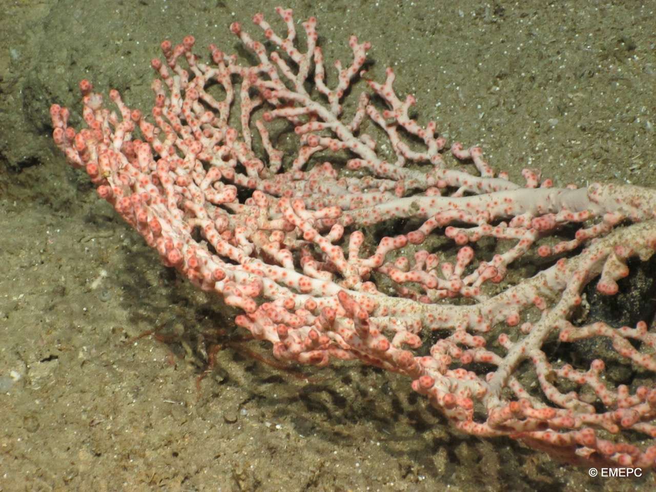
Main objective: MapGES 2024 continues our longstanding commitment to map deep-sea biodiversity and identifying Vulnerable Marine Ecosystems (VMEs) in the Azores with the Azor drift-cam imagery system. Our 2024 expedition aimed to enhance the data collected in previous surveys by conducting new video transects along the slopes of several islands in the archipelago, including São Miguel and the northern Mar da Prata, Graciosa, Ponta da Ilha N in the Southeast of Pico Island, as well as Flores, Corvo, and Terceira Islands. This fieldwork focused on under-sampled areas and deeper strata. Additionally, we planned to explore two new areas, specifically Ilha Azul W and Raio Seamount. Our ultimate goal is to achieve a comprehensive understanding of the deep-sea fauna dwelling on the slopes, banks, and seamounts in these areas. Like previous MapGES cruises, our objectives included: (i) mapping benthic communities in previously unexplored seamounts, ridges, and island slopes; (ii) identifying new areas that meet the FAO definition of Vulnerable Marine Ecosystems; and (iii) determining the distribution patterns of deep-sea benthic biodiversity in the Azores. The results of this cruise added to the previous contributions to identify the environmental drivers that determine the spatial distribution of deep-sea benthic biodiversity in the Azores. It also provides valuable information in the context of Good Environmental Status (GES), Marine Spatial Planning (MSP) and new insights on how to sustainably manage deep-sea ecosystem. Methodology: We conducted several underwater video transects along the seafloor using the Azor drift-cam, a cost-effective drifting camera system developed by IMAR and Okeanos at the University of the Azores. This system is capable of recording high-quality underwater video images of the seabed down to 1000 m depth, and it was deployed from the MT Physeter. Cruise summary: The MapGES 2024 cruise aboard MT Physeter consisted of 4 legs aimed at exploring and revisiting slopes, banks, ridges, and seamounts surrounding São Miguel, Graciosa, Pico, Flores, Corvo, and Terceira Islands. A total of 150 successful dives were conducted out of 153 planned, covering 28 sampling areas and approximately 80km of the seafloor and generated more than 150 hours of video footage for analysis. During Leg 1, from 30th June to 17th July 2024, we performed 40 successful dives with the Azor drift-cam. This first Leg surveyed the deep-sea benthic communities dwelling on the slopes of the geomorphological structures around São Miguel Island and the north part of the Mar da Prata seamount. This was a challenging leg due to the bad weather conditions throughout the mission. During the Leg 2, from 21st July to 1st August 2024, we performed 48 successful dives with the Azor drift-cam around Graciosa Island slopes and some adjacent geomorphological structures such as Ilha Azul and Mar da Fortuna. We also revisited the south of Pico Island namely the northernmost part of a seamount chain area called Ponta da Ilha. The explorations of the Ponta da Ilha N was unexpectedly challenging due to its geomorphology, being even more difficult when operating with a small vessel such as MT Physeter. During Leg 3, from 9th to 22sd August 2024, we performed 43 dives in the island slopes around Flores and Corvo. During Leg 4, from 26th August to 7th September we performed a total of 22 dives with the Azor drift-cam, a little less than the usual number because of the constant bad sea conditions. Nevertheless, we were able to revisit the Terceira Island slopes and the adjacent banks and seamounts. Main achievements: During the MapGES 2024 survey conducted aboard the MT Physeter, 153 stations were completed using the Azor drift-cam. The stations spanned depths ranging from 100 to 1130 m, encompassing a broad spectrum of marine strata. The survey covered approximately 80km of the seafloor and generated more than 150 hours of video footage for analysis. These numbers represent a big achievement considering that (i) we successfully operated, once again, the Azor drift-cam for deep-sea exploration on board a small vessel and (ii) a great part of the days at the sea were characterized by an extremely challenging weather, especially during Leg 1 and 4 around São Miguel and Terceira Islands. This year’s survey included a diverse set of locations, involving Ilha Azul, Raio seamount, and the northern extension of the Ponta da Ilha volcano chain. This volcanic structure, extending nearly 40 nautical miles from the eastern tip of Pico Island, is still just slightly explored due to the time and vessel limitations and definitely deserves a more in-depth exploration. Due to its particular geomorphology, which is made up of a chain of many narrow seamounts, deploying the Azor drift-cam and passing over the top of the seamounts was a very difficult task, as most of the time the structure only passed along one flank of the hill. For the second consecutive year of the MapGES survey on-board the MT Physeter, no entire Azor drift-cam structures were irretrievably lost despite entanglements with discarded fishing lines or contact with big basaltic outcrops. The successful retrieval of all deployed gear, with only minor damage during all the campaign, underscores the team’s preparedness and their effective response to challenging situations. The MapGES 2024 survey was substantially focused on investigating deeper strata in areas already visited during the previous campaigns. Exploration of these deeper zones provided a more comprehensive understanding of deep-sea biodiversity, so that we can manage to fill some knowledge gaps about the benthic communities present in some of the areas. Several rare or less frequently encountered species were observed using the Azor drift-cam, notablyincluding swordfish (Xiphias gladius), the European spiny lobster (Palinurus elephas), the smalltooth sandtiger shark (Odontaspis ferox), and a species of sponge tentatively identified as cf. Hertwigia falcifera. Wealso had the opportunity to record two different species belonging to the genus Halosaurus, being this fact notable because it was only recorded for the first time with the Azor drift-cam during MapGES 2023 survey. Although no particularly large or spectacular coral communities were detected, several diverse coralgardens were identified, particularly around Terceira Island. These included notable gorgonian species such as Dentomuricea aff. meteor, Acanthogorgia spp., Viminella flagellum, and Paracalyptrophora josephinae. Outstanding coral gardens dominated by the octocoral Dentomuricea aff. meteor had been reported during the MapGES 2023 survey around Terceira Island, and this year, revisiting nearby areas, it wasn’t possible to observe exemplars as a large as last year, probably mainly due to explorations at deeper sectors. During this year campaign, when in São Miguel, we were able to witness what it could be one of the most extensive and with the largest individuals of the gorgonian Candidella cf. imbricata ever recorded with the Azor drift-cam. These aggregations were sighted on Mar da Prata N, and the observation is particularly relevant because of the apparently good coral status and because this area is strongly known for the concentration of significant part of the bottom fishing effort in the Azores region. We detected an extraordinary aggregation of the “bird’s nest” sponge Pheronema carpenteri in Ponta daIlha N (Southeast of Pico Island). There is a high chance that this is one of the densest and largest fieldsmainly composed by this sponge, that we have recorded with the Azor-drift cam, growing on a large flatarea characterized by soft and unconsolidated substrate. This reinforces the idea that this is most certainly the sponge species we encounter most frequently and in higher densities, across a relatively large depth range.

Authors

15 involved team members

Record details

Type
report
Language
EN

Keywords

Biodiversity Transect Geography Context (archaeology) Benthic zone Seamount Cruise Oceanography Fauna Environmental resource management Marine spatial planning Sustainability Ecosystem Environmental data Fishery Marine biodiversity Marine protected area Environmental monitoring Bathymetry Marine conservation Physical geography Ecology Environmental science Marine ecosystem Remote sensing

Follow us on social media to stay updated

Location

Institute of Marine Sciences — Okeanos, University of the Azores

Departamento de Oceanografia e Pescas — Universidade dos Açores

Rua Prof. Doutor Frederico Machado, No. 4
9901-862 Horta, Portugal

Contact

FOLLOW US —
ADSR

AZORES DEEP-SEA RESEARCH © 2020-2026 — RELEASE 2.1

Developed by Valter Medeiros VALTER MEDEIROS