Loading…
Loading…
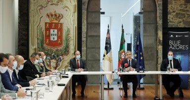
Blue Azores
Blue Paper Cooperation protocol
Blue Azores
Loading project…
Blue Paper Cooperation protocol
Period: 01 Jan 2019 to 31 Dec 2021
Funding: 1 source(s)
01 Jan 2019 to 31 Dec 2021
Fundação Oceano Azul
Budget: 110,000.00 €
Summary
Blue Paper Cooperation protocol
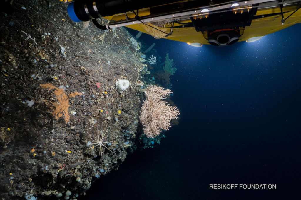
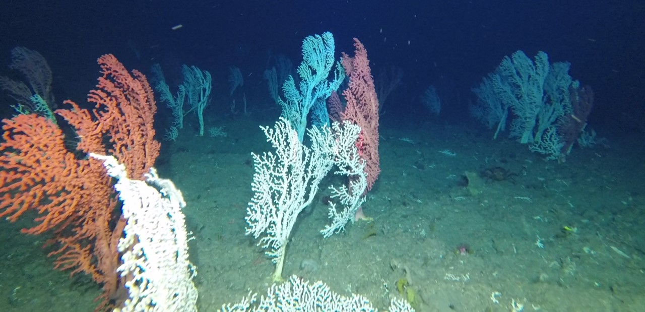
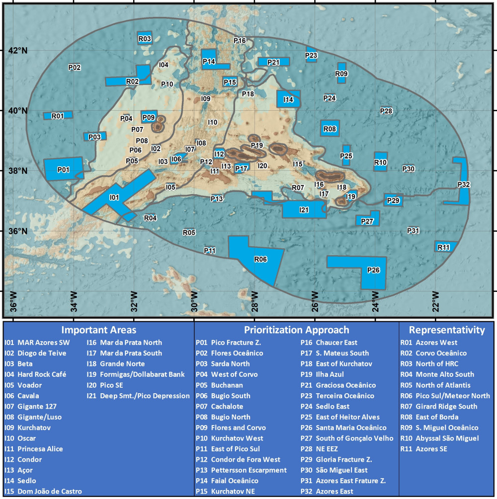
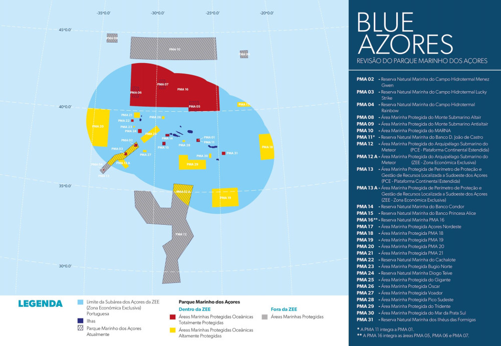
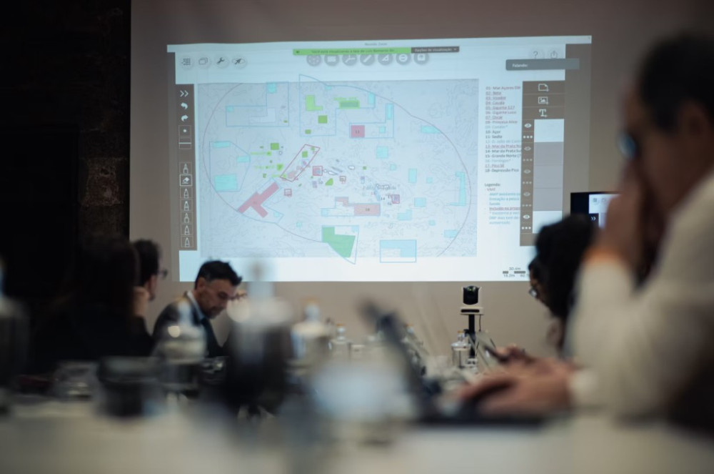
The implementation of a network of marine protected areas can yield significantly different outcomes in the short, medium, and long term, depending critically on their size, shape, placement, and spacing. To navigate these complex design choices and achieve specific management goals, explicit, objective-driven, and quantitative approaches are essential. The Blue Azores project employed systematic conservation planning (SCP) to develop multiple scenarios for fisheries closures. This process was guided by the overarching goal of protecting the natural diversity, ecosystem structure, function, and resilience of deep-sea communities within the Azores Exclusive Economic Zone, while still permitting the environmentally sustainable use of marine resources for current and future generations.
As the Azores' deep-sea Blue Growth potential expand, balancing economic development with conservation is critical. Our past research has generated crucial data and innovative modelling tools, yielding a deeper understanding of deep-sea ecosystem functions, biodiversity patterns, and the cumulative impacts of human activity. These insights are now being applied to improve adaptive, ecosystem-based management and systematic conservation planning. This project aims to support the Blue Azores program to identify and protect the region's most critical deep-sea areas.
Our Team's role
We lead the projected and conducted all tasks and deliverables.
Collaborators
Accomplished missions
Main results
The systematic conservation planning for the deep-water of the Azores, suggested the prioritization outputs are highly dependent on the goals and objectives adopted. It also highlighted that the prioritization outputs, but also the performance assessment and the forecasted impact of management measures depend on the range of conservation features, representation targets, cost model, boundary penalties, and constraints considered.






 ATLAS
A transatlantic assessment and deep-water ecosystem-based spatial management plan for Europe
Funded by European Union’s Horizon 2020
Blue Azores
Blue Paper Cooperation protocol
Funded by Fundação Oceano Azul
ATLAS
A transatlantic assessment and deep-water ecosystem-based spatial management plan for Europe
Funded by European Union’s Horizon 2020
Blue Azores
Blue Paper Cooperation protocol
Funded by Fundação Oceano Azul
 iAtlantic
Integrated Assessment of Atlantic Marine Ecosystems in Space and Time
Funded by European Union’s Horizon 2020
iAtlantic
Integrated Assessment of Atlantic Marine Ecosystems in Space and Time
Funded by European Union’s Horizon 2020
 iMAR
Integrated assessment of the distribution of Vulnerable Marine Ecosystem along the Mid-Atlantic Ridge in the Azores region
Funded by European Union’s Horizon 2020
iMAR
Integrated assessment of the distribution of Vulnerable Marine Ecosystem along the Mid-Atlantic Ridge in the Azores region
Funded by European Union’s Horizon 2020
 MapGES
Mapping deep-sea biodiversity and “Good Environmental Status” in the Azores: assisting with the implementation of EU Marine Strategy Framework Directive
Funded by Regional Government of the Azores, PO Açores 2020, European Regional Development Fund (ERDF / FEDER)
MapGES
Mapping deep-sea biodiversity and “Good Environmental Status” in the Azores: assisting with the implementation of EU Marine Strategy Framework Directive
Funded by Regional Government of the Azores, PO Açores 2020, European Regional Development Fund (ERDF / FEDER)
 MapGES2
Characterization of deep-sea habitats, for its mapping up to the outer limit of the Azores sub-area of the Portuguese Exclusive Economic Zone
Funded by Regional Government of the Azores, EU, ACORES-14-62G4-FEDER-000001, PO Açores 2020, REACT-EU, ERDF
MapGES2
Characterization of deep-sea habitats, for its mapping up to the outer limit of the Azores sub-area of the Portuguese Exclusive Economic Zone
Funded by Regional Government of the Azores, EU, ACORES-14-62G4-FEDER-000001, PO Açores 2020, REACT-EU, ERDF
 MarinePlan
Improved transdisciplinary science for effective ecosystem-based maritime spatial planning and conservation in European Seas
Funded by European Union’s Horizon Europe
MarinePlan
Improved transdisciplinary science for effective ecosystem-based maritime spatial planning and conservation in European Seas
Funded by European Union’s Horizon Europe
 MERCES
Marine Ecosystem Restoration in Changing European Seas
Funded by European Union’s Horizon 2020
MERCES
Marine Ecosystem Restoration in Changing European Seas
Funded by European Union’s Horizon 2020
 REDRESS
Restoration of deep-sea habitats to rebuild European Seas
Funded by European Union’s Horizon Europe
ATLAS
A transatlantic assessment and deep-water ecosystem-based spatial management plan for Europe
Funded by European Union’s Horizon 2020
Blue Azores
Blue Paper Cooperation protocol
Funded by Fundação Oceano Azul
iAtlantic
Integrated Assessment of Atlantic Marine Ecosystems in Space and Time
Funded by European Union’s Horizon 2020
MapGES
Mapping deep-sea biodiversity and “Good Environmental Status” in the Azores: assisting with the implementation of EU Marine Strategy Framework Directive
Funded by Regional Government of the Azores, PO Açores 2020, European Regional Development Fund (ERDF / FEDER)
MERCES
Marine Ecosystem Restoration in Changing European Seas
Funded by European Union’s Horizon 2020
ATLAS
A transatlantic assessment and deep-water ecosystem-based spatial management plan for Europe
Funded by European Union’s Horizon 2020
Blue Azores
Blue Paper Cooperation protocol
Funded by Fundação Oceano Azul
REDRESS
Restoration of deep-sea habitats to rebuild European Seas
Funded by European Union’s Horizon Europe
ATLAS
A transatlantic assessment and deep-water ecosystem-based spatial management plan for Europe
Funded by European Union’s Horizon 2020
Blue Azores
Blue Paper Cooperation protocol
Funded by Fundação Oceano Azul
iAtlantic
Integrated Assessment of Atlantic Marine Ecosystems in Space and Time
Funded by European Union’s Horizon 2020
MapGES
Mapping deep-sea biodiversity and “Good Environmental Status” in the Azores: assisting with the implementation of EU Marine Strategy Framework Directive
Funded by Regional Government of the Azores, PO Açores 2020, European Regional Development Fund (ERDF / FEDER)
MERCES
Marine Ecosystem Restoration in Changing European Seas
Funded by European Union’s Horizon 2020
ATLAS
A transatlantic assessment and deep-water ecosystem-based spatial management plan for Europe
Funded by European Union’s Horizon 2020
Blue Azores
Blue Paper Cooperation protocol
Funded by Fundação Oceano Azul
 DeepWalls
Exploring pristine deep-sea walls to establish baselines for Good Environmental Status in the Azores
Funded by Regional Government of the Azores, PO Açores 2020, European Regional Development Fund (ERDF / FEDER)
iAtlantic
Integrated Assessment of Atlantic Marine Ecosystems in Space and Time
Funded by European Union’s Horizon 2020
MapGES
Mapping deep-sea biodiversity and “Good Environmental Status” in the Azores: assisting with the implementation of EU Marine Strategy Framework Directive
Funded by Regional Government of the Azores, PO Açores 2020, European Regional Development Fund (ERDF / FEDER)
MERCES
Marine Ecosystem Restoration in Changing European Seas
Funded by European Union’s Horizon 2020
DeepWalls
Exploring pristine deep-sea walls to establish baselines for Good Environmental Status in the Azores
Funded by Regional Government of the Azores, PO Açores 2020, European Regional Development Fund (ERDF / FEDER)
iAtlantic
Integrated Assessment of Atlantic Marine Ecosystems in Space and Time
Funded by European Union’s Horizon 2020
MapGES
Mapping deep-sea biodiversity and “Good Environmental Status” in the Azores: assisting with the implementation of EU Marine Strategy Framework Directive
Funded by Regional Government of the Azores, PO Açores 2020, European Regional Development Fund (ERDF / FEDER)
MERCES
Marine Ecosystem Restoration in Changing European Seas
Funded by European Union’s Horizon 2020
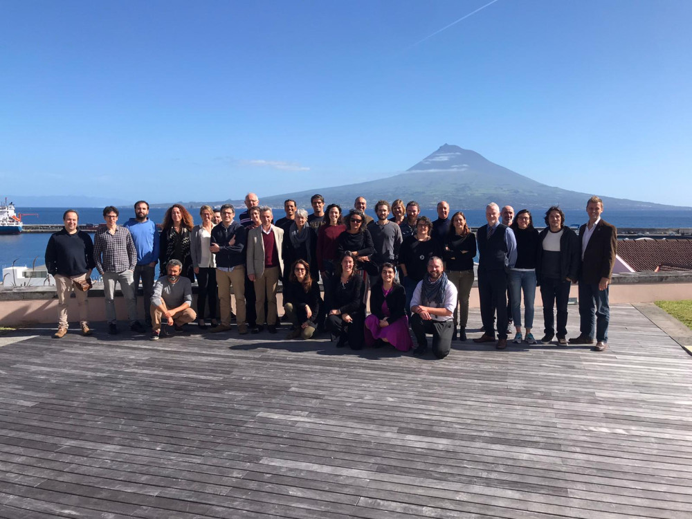
Blue Azores Gallery








Location
Departamento de Oceanografia e Pescas — Universidade dos Açores
Rua Prof. Doutor Frederico Machado, No. 4
9901-862 Horta, Portugal
Contact
Email: azoresdeepsea@gmail.com

AZORES DEEP-SEA RESEARCH © 2020-2026 — RELEASE 2.1
 VALTER MEDEIROS