AZORES
DEEP-SEA RESEARCH © CRUISES
Stations
BlueAzores 2019
Loading…
BlueAzores 2019
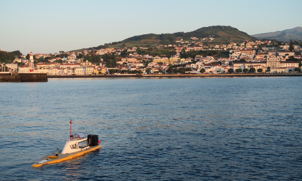
Dives with LULA1000 in Baixo de São Mateus
BlueAzores 2019
Loading cruise data…
Dives with LULA1000 in Baixo de São Mateus
Location: Baixo de São Mateus
Year: 2019
2 stations
2 dives
20 km transits
1 areas visited
Summary
Dives with LULA1000 in Baixo de São Mateus
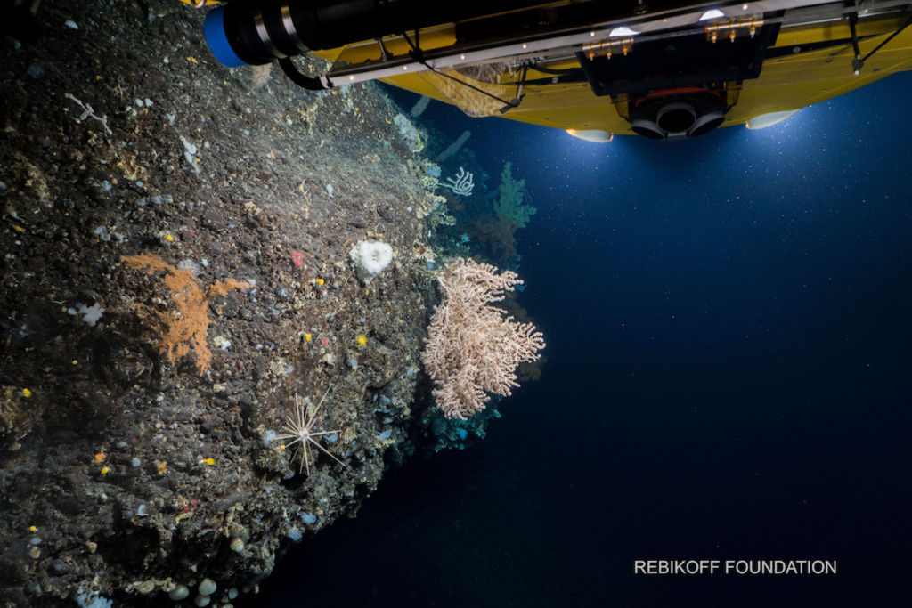
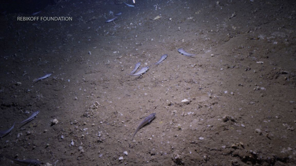
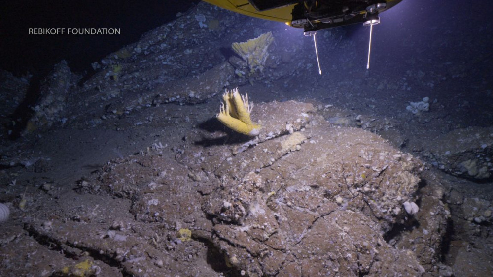
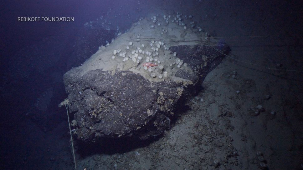
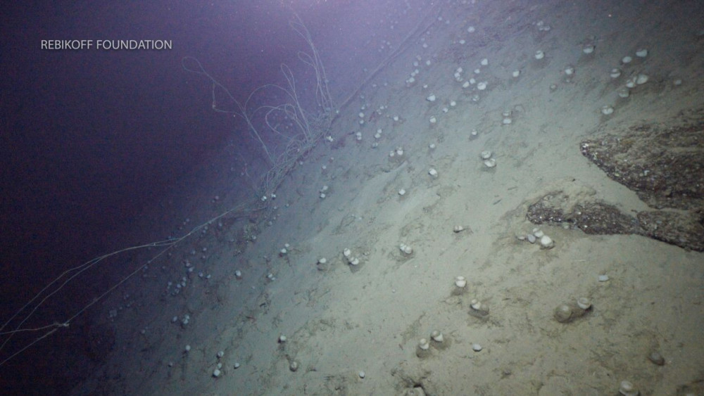
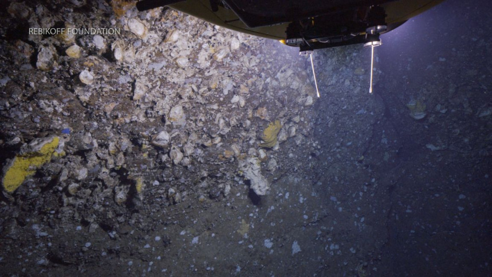
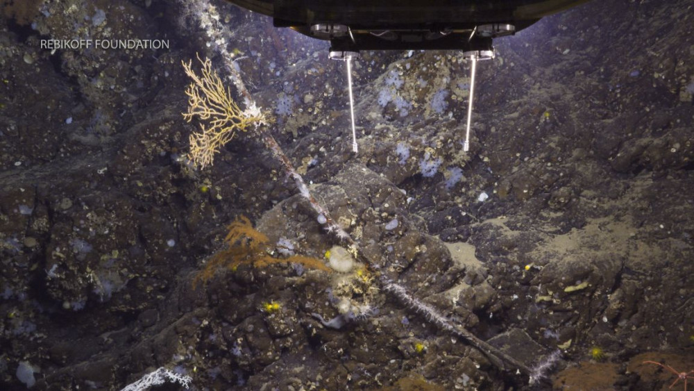
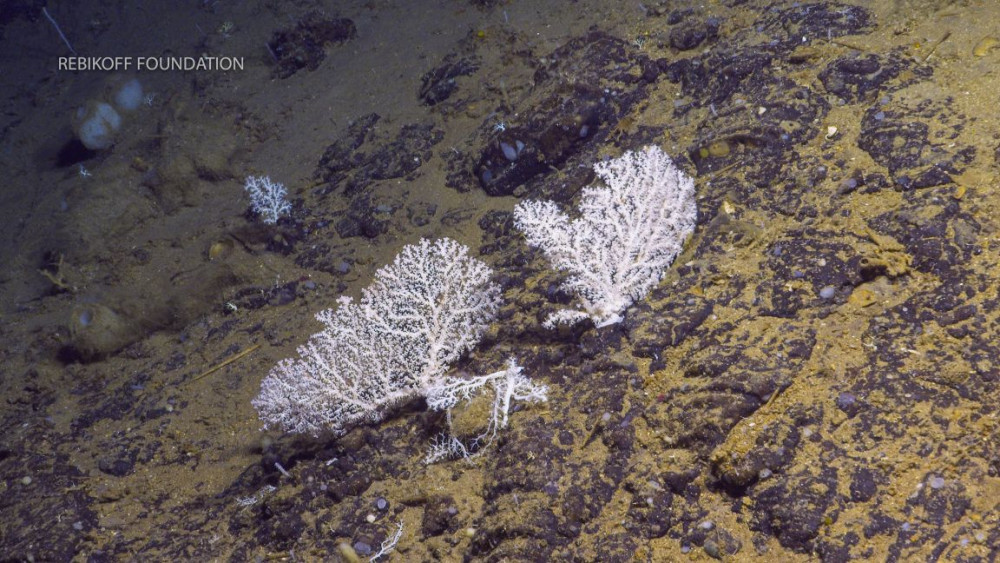
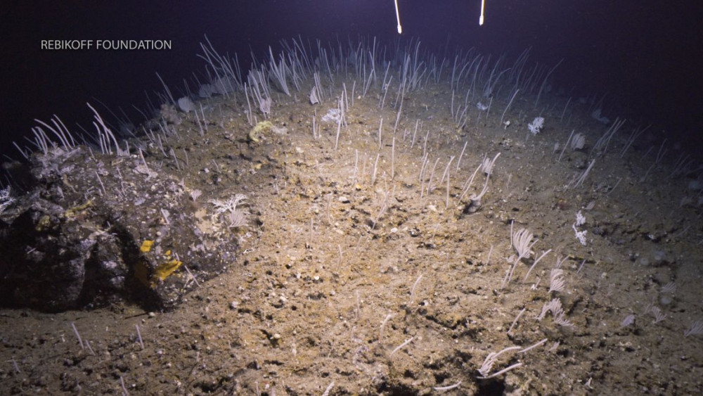
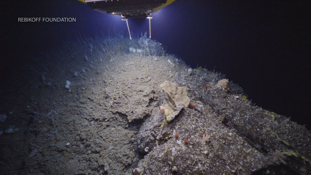
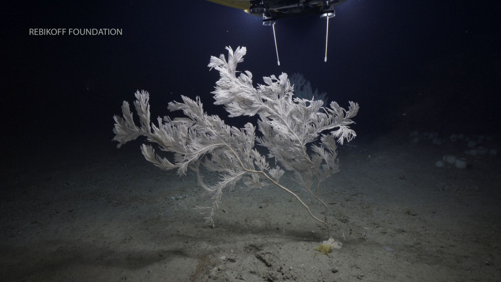
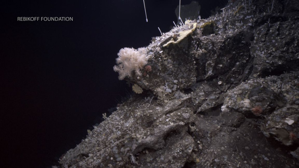
The primary objective of this survey was to evaluate if the Baixo de São Mateus seamount ridge fits the FAO criteria that define what constitutes a Vulnerable Marine Ecosystem (VME). Namely, the IMAR/Okeanos team from the University of the Azores aimed to: characterize the diversity and spatial distribution patterns of benthic communities and commercial fishes in this important historical fishing ground, and document potential fishing impacts on the main structuring species that form the different benthic communities. By utilizing the unique capabilities of the LULA1000 manned submersible, which allowed for close-up observation of steep slopes and vertical walls, the team conducted two exploratory dives covering 3.7 linear kilometers. The data collected on benthic community zonation and anthropogenic pressure was used to perform a formal expert assessment against the five FAO VME criteria, informing management recommendations for the region.
By taking advantage of the collaboration with the Rebikoff-Niggeler Foundation and the use their submersible LULA1000, based in the harbour of Horta (Faial), we aimed to explore the never surveyed seamount ridge Baixo de São Mateus. The primary goal was to explore the never-before-surveyed seamount ridge south of Pico Island to evaluate its potential as a Vulnerable Marine Ecosystem (VME). These dives were conducted under the protocol between IMAR University of the Azores and the Blue Ocean Foundation.
Statistics
Highlights
Location of operation
Baixo de São Mateus
Stations
BlueAzores 2019
Activities
Funding
Cruise crew
Chief scientist
Collaborators
Images
Dives images


Location
Departamento de Oceanografia e Pescas — Universidade dos Açores
Rua Prof. Doutor Frederico Machado, No. 4
9901-862 Horta, Portugal
Contact
Email: azoresdeepsea@gmail.com
AZORES DEEP-SEA RESEARCH © 2020-2026 — RELEASE 2.1
 VALTER MEDEIROS