MapGES

Mapping deep-sea biodiversity and “Good Environmental Status” in the Azores: assisting with the implementation of EU Marine Strategy Framework Directive

Logo

MapGES

Loading project…

Mapping deep-sea biodiversity and “Good Environmental Status” in the Azores: assisting with the implementation of EU Marine Strategy Framework Directive

Reference: ACORES-01-0145-FEDER-00056

Period: 01 Sep 2016 to 31 Dec 2019

Funding: Regional Government of the Azores, PO Açores 2020, European Regional Development Fund (ERDF / FEDER)

AZORES DEEP-SEA RESEARCH
Project reference

ACORES-01-0145-FEDER-00056


Time period

01 Sep 2016 to 31 Dec 2019


Funding agencies

Regional Government of the Azores, PO Açores 2020, European Regional Development Fund (ERDF / FEDER)


Summary

Mapping deep-sea biodiversity and “Good Environmental Status” in the Azores: assisting with the implementation of EU Marine Strategy Framework Directive

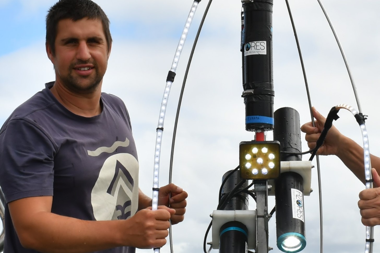
To achieve this ambition, the main objectives of MapGES were: (1) to improve the understanding, model and map biodiversity of different types of VMEs indicator taxa and key deep-sea fish species across the Azores EEZ; (2) to apply indicators of GES relevant to the Azores deep-sea ecosystems for the MSFD and its constituent descriptors; (3) measure and predict changes in biodiversity and species biogeography in the Azores under future scenarios of dynamics of the North Atlantic; and (4) identify priority areas for management and conservation in the Azores as a precursor to the future development of an Atlantic wide Marine Protected Area (MPA) network. MapGES employed a multitude of methodologies ranging from desktop studies to build upon past scientific results, new imagery data collection using state-of-the-art research cruises technologies, new methodologies to measure baseline values of GES, state-of-the-art species distribution models coupled with detailed analysis of North Atlantic circulation to predict changes in biodiversity and species biogeography, and new methods to identify priority areas for conservation in the Azores.

MapGES was built closely linked with the Horizon 2020 ATLAS project and envisioned to bring together existing and new biodiversity data and results from recent analysis of the dynamics of the North Atlantic to deepen the understanding of the biodiversity and biogeographic patterns of Vulnerable Marine Ecosystems (VMEs) indicator taxa and key deep-sea fish species in the Azores and forecast changes under future scenarios of water mass structure and ocean currents. With MapGES, we anticipated this new understanding will improve the application of indicators of Good Environmental Status (GES) relevant to the Azores ecosystems for the Marine Strategy Framework Directive (MSFD) and its constituent descriptors.

Show less ↑
Show more ↓

Our Team's role

Azores Deep-sea Research

We lead the MapGES project, all the workpackages, and the outreach activities.

Main results

MapGES contributed with baseline data, new analyses and information to the priority thematic area Fisheries and Oceans, mostly to positioning the Azores in the centre of the deep-sea marine research, knowledge transfer, resources management and governance. MapGES contributed to more than ten areas of action within the RIS3 Azores framework and contributed new data to inform the implementation of several political agendas. For example, MapGES contributed with data-driven spatial systematic conservation planning scenarios to inform marine spatial planning processes in the Azores, and therefore contributing to the implementation of the Marine Strategy Framework Directive. MapGES also contributed a significant amount of scientific knowledge on Vulnerable Marine Ecosystems in support of the implementation of protection measures that will have an important impact in terms of fisheries regulations and sustainable exploitation of the Azores' fishing grounds. MapGES was built closely linked with the Horizon 2020 ATLAS project and, therefore, shared many of the main results.
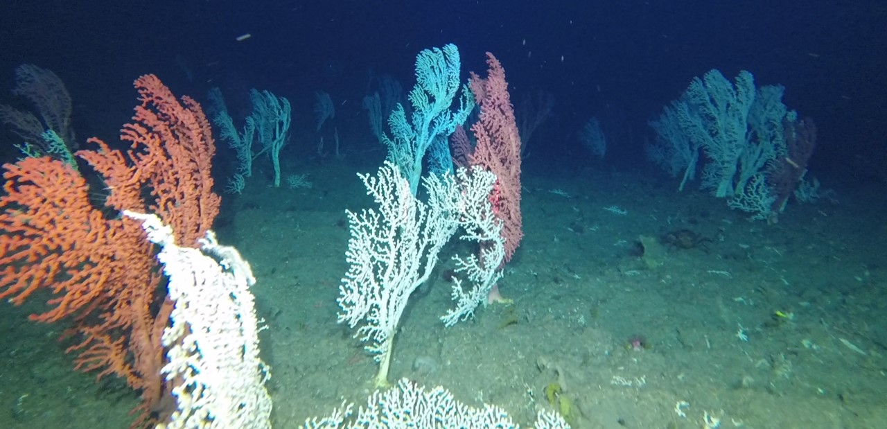
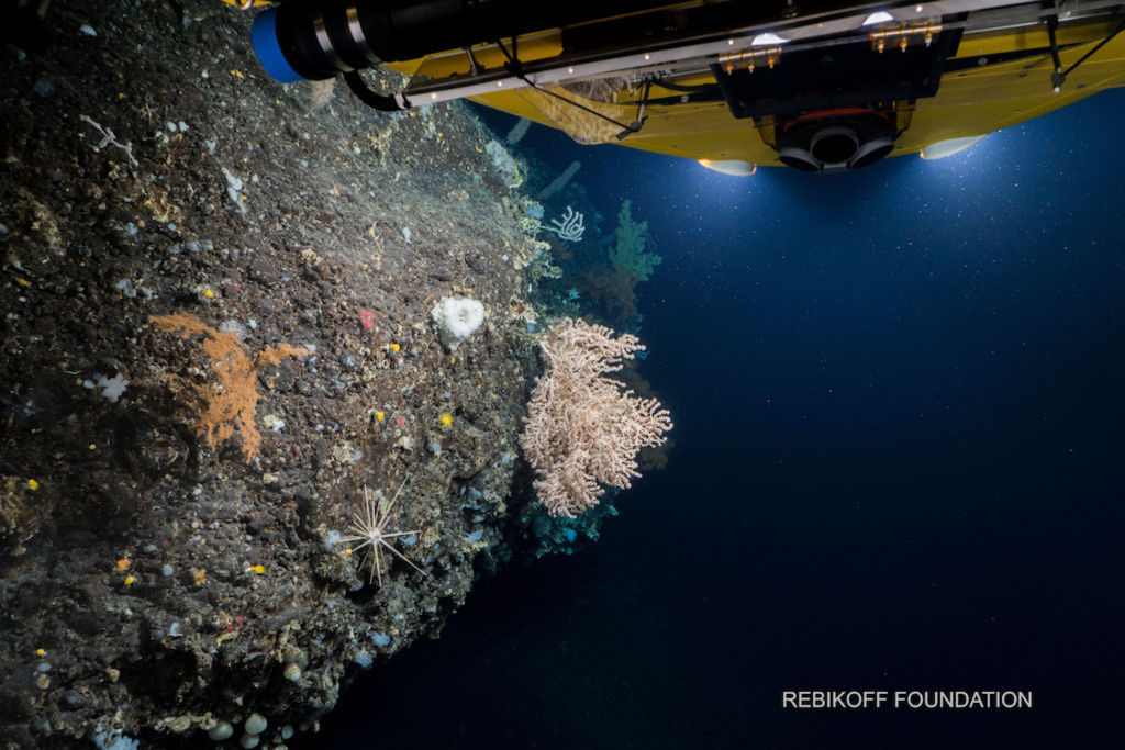
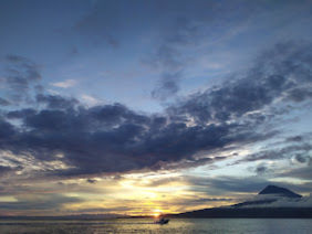
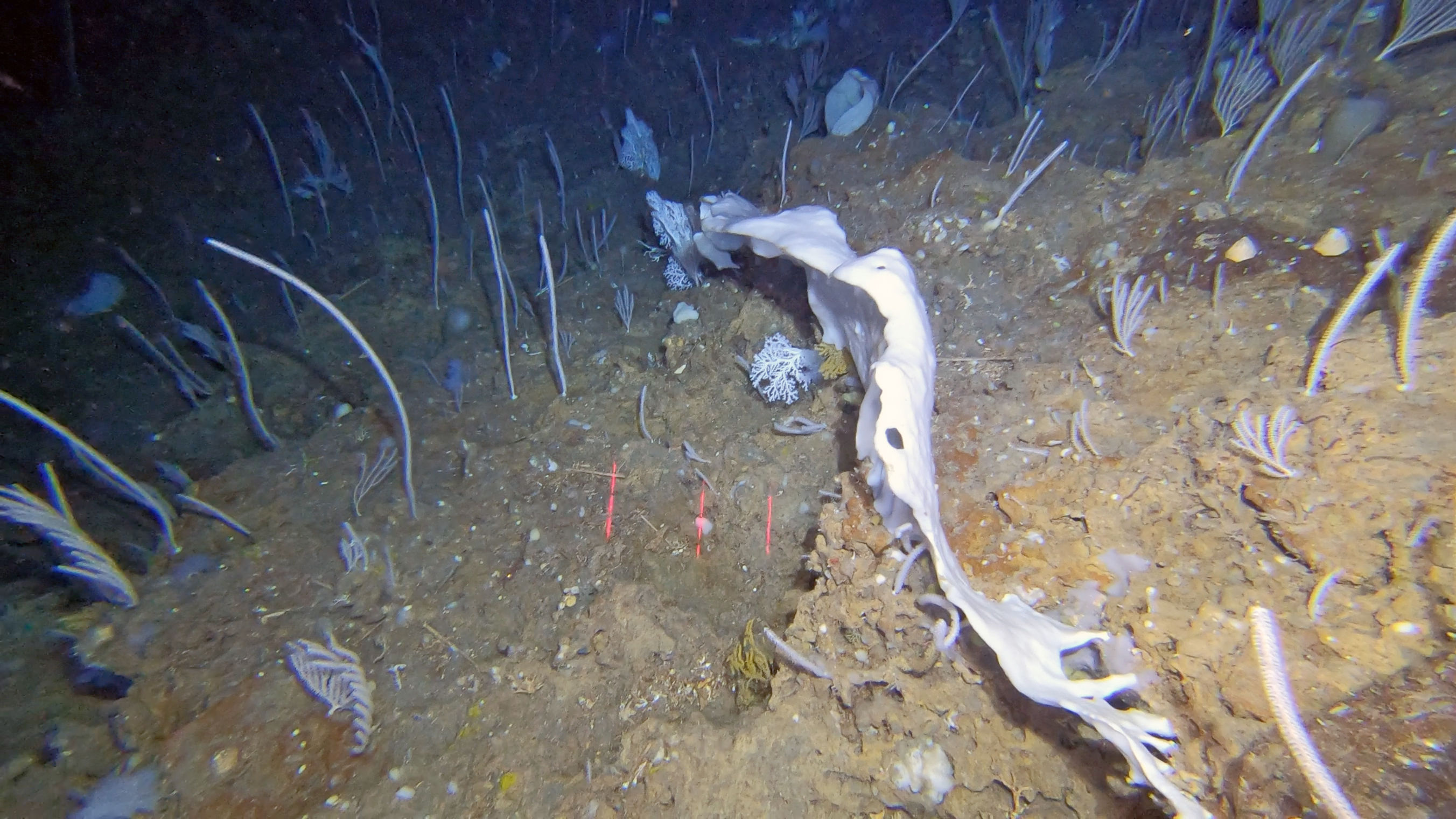
  1. New multibeam bathymetry data has been compiled and added to the ADSR database from recent oceanographic surveys recently carried out in the Azores EEZ. New data has increased the area of fine-scale seabed bathymetry data.
  2. New specimens have been added, together with relevant information about their taxonomy and biogeography to “Coleta” database; the most representative collection of Azorean benthic biodiversity currently stored at IMAR. The species database currently holds 10,299 entries, 23% of which correspond to coral species.
  3. MapGES had the vision to develop a low-cost imagery system for rapid appraisals of the deep sea. The Azor drift-cam was born in 2019, providing the possibility of exploring the slopes and summits of shallow seamounts and ridges, as well as shelf areas around the islands, without the need of large oceanographic vessels and high budgets. During the MapGES project, the Azor drift-cam has been successfully deployed over 160 times, covering almost 100 linear km of the seabed and has generated more than 120 hours of seafloor images.
  4. Deep-sea discoveries: The Azores region was found to harbour particularly diverse coral gardens, forming at least seven distinct coral garden communities dominated by different species of octocorals discovered during ATLAS/MapGES cruises. Both historical and new knowledge generated during ATLAS/MapGES have demonstrated the Azores as a hotspot of CWC diversity, representing the highest species richness known of Octocorallia in Europe and in any of the North Atlantic archipelagos. ATLAS/MapGES also contributed to the identification of several new species to science.
  5. New hydrothermal vent discovered: A new hydrothermal vent field was discovered on the slopes of Gigante, a seamount on the Mid-Atlantic Ridge in the seas of the Azores. This system differs considerably from other known hydrothermal fields along the MAR in terms of fluid chemistry with dominance of hydrogen and iron, and low temperature. The ‘Luso’ hydrothermal vent field was declared as No Fishing Area in 2019 (Portaria no. 68/2019).
  6. New areas that fit the Vulnerable Marine ecosystem criteria: Eight areas in the Azores were identified as VMEs composed of diverse coral gardens, deep-sea sponge aggregations and hydrothermal Vent. These were Cavalo Seamount, a ridge on the Mid-Atlantic Ridge, Gigante Seamount, Condor Seamount, Dom João de Castro Seamount, and Mar de Prata Seamount because of various coral gardens; the South of Pico Island because of a deep-sea sponge aggregation of Pheronema carpenter; and the newly discovered Hydrothermal Vent Luso.
  7. Predicted distribution: Habitat suitability models developed for 13 vulnerable marine ecosystems indicator taxa in the Azores EEZ, showed a strong association of the predicted distribution of CWC taxa with areas of local relief, being them island shelves or slopes, ridges or seamounts. However, even among areas of similar depths, models discriminated between suitable and unsuitable zones showing that model outputs were not exclusively driven by depth correlated changes in environmental predictors.
  8. Impact of climate change on food supply and survival of deep-sea ecosystems: Results from a series of ATLAS experiments on the physiology of cold-water corals and deep-water sponges revealed that cumulative effects of climate change on food supply and ocean acidification impact the distribution and function of corals. This work highlighted that, as a result of climate change, predicted decreases in food availability and responses to ocean acidification will likely impact long-term growth and life cycles of corals. A better understanding of the interactive effects of climate change on deep-sea ecosystems supports accurate monitoring, modelling and future predictions.
  9. Predictive maps for future habitat suitability: ATLAS/MapGES have modelled and developed predictive maps of habitat suitability for six cold-water coral and six deep-sea fish species under current conditions and forecast changes under future projected high-emission climate conditions for the whole North Atlantic Ocean. The results forecasted that over 50% of cold-water coral habitats could be at risk, and suitable habitats for commercially important deep-sea fish could shift by up to 100 km northwards. This work has important implications for the designation of effective area-based conservation measures and adaptive management strategies.
  10. Good Environmental Status in the deep-sea: ATLAS/MapGES participated in a preliminary assessment of the environmental status of selected North Atlantic deep-sea ecosystems. We suggested that the low availability of long-term data sets limits our knowledge about natural variability and human impacts in the deep sea preventing a more systematic assessment of habitat and ecosystem components in the deep sea.
  11. An index to identify biodiversity hotspots: ATLAS/MapGES developed a novel multi-criteria assessment method to more objectively identify Vulnerable Marine Ecosystems (VMEs) in the North-East Atlantic Ocean, often biodiversity hotspots. The method evaluates how likely a given area of seafloor is to represent a VME, providing a more systematic and standardised approach (robust and repeatable numeric method) for assessing and identifying VME regions in the North-East Atlantic Ocean.
  12. ATLAS/MapGES developed systematic conservation planning approaches to support area-based management plans in the Azores and in the North Atlantic Ocean.
Show less ↑
Show more ↓
Nothing to show yet... Try again later.
North Atlantic basin-scale multi-criteria assessment database to inform management recommendations to protect Vulnerable Marine Ecosystems
Nov, 2020
7 team members are authors
OA DOI 10.5281/zenodo.4279776
Authors 10.5281/zenodo.4279776
Telmo Morato
Christopher K. Pham
Laurence Fauconnet
Gerald H. Taranto
Giovanni Chimienti Erik E. Cordes
Carlos Dominguez‐Carrió
P. Durán-Muñoz Hrönn Egilsdóttir José Manuel González‐Irusta Anthony Grehan Dierk Hebbeln Lea‐Anne Henry Georgios Kazanidis Ellen Kenchington Lénàïck Menot Tina N. Molodtsova Covadonga Orejas Berta Ramiro‐Sánchez
Manuela Ramos
Luís Rodrigues
Steve W. Ross José L. Rueda M.m. Sacau-Cuadrado David Stirling
Marina Carreiro‐Silva
Abstract
We applied the International Council for the Exploration of the Sea (ICES) multi criteria assessment (MCA) method for identifying VMEs in the North-East Atlantic (ICES, 2016a,b; Morato et al., 2018) from ATLAS VME database to provide the first North Atlantic Ocean basin-scale VME assessment. This MCA is a taxa-dependent spatial method that incorporates the fact that not all VME indicators have the same vulnerability to human impacts, and thus should not be weighted equally. By including a measure of the confidence associated with each VME record, this methodology also considers some of the uncertainties associated with the sampling methodologies, the reported taxonomy, and data quality issues. Equally important, this dataset highlights areas in the North Atlantic that have been poorly sampled and that require further attention. Finally, this methodology also allows for the evaluation and comparison of the VME likelihood with spatial fisheries data that may directly generate significant adverse impacts on VMEs. In the data report, we made the “North Atlantic basin-scale VME index dataset” publicly, thus allowing its consultation and use by scientists, managers, or other relevant stakeholders.
GIS layers of seafloor characteristics in the Azores region (North Atlantic), links to files in ArcGIS format
Jan, 2016
1 team member is author
OA Citations 1 DOI 10.1594/pangaea.862152
Authors 10.1594/pangaea.862152
Antonio David Perán Miñarro Christopher K. Pham Patrícia Amorim Frederico Cardigos Fernando Tempera
Telmo Morato
Abstract
Current European legislation such as the Marine Strategy Framework Directive (MSFD; 2008/56/EC) has highlighted the need for accurate maps on the geomorphology of Europe's maritime territory. Such information is notably essential for the production of habitat maps and cumulative impact assessments of human activities (Halpern et al., 2008) necessary for marine spatial planning initiatives (Gilliland and Laffoley, 2008) and assessments of the representativity/sufficiency of marine protected areas networks like Natura 2000. Broadscale satellite bathymetry presently allows the identification of all prominent geomorphic structures present on the seafloor with a high grade of accuracy. However, these datasets and maps still need to be more widely disseminated in the scientific community.In this contribution, we provide an inventory of some important datasets related to the physical characteristics of the seafloor surrounding the Azores Archipelago. The objective is to ensure that our compilation is readily available for any researchers interested in developing species distribution models, or for the management and conservation of natural resources in the region.
Ocean climatology in the Azores region (North Atlantic) and seabed characteristics, links to GIS layers in ArcGIS format
Jan, 2017
1 team member is author
OA DOI 10.1594/pangaea.872601
Authors 10.1594/pangaea.872601
Patrícia Amorim António D. Perán Christopher K. Pham Manuela Juliano Frederico Cardigos Fernando Tempera
Telmo Morato
Abstract
Obtaining a comprehensive knowledge of the spatial and temporal variations of the environmental factors characterizing the Azores region is essential for conservation and management purposes. Although many studies are available for the region, there is a need for a general overview of the best available information. Here, we assembled a comprehensive collection of environmental data for this region. Data sources used in this study included remote sensing oceanographic data for 2003?2013 (sea surface temperature, chlorophyll-a concentration, particulate inorganic carbon (PIC), and particulate organic carbon (POC)), derived oceanographic data (primary productivity and North Atlantic oscillation index) for 2003?2013, and in situ data (temperature, salinity, oxygen, phosphate, nitrate and silicate) obtained from the World Ocean Atlas 2013.
Climate-induced changes in the suitable habitat of cold-water corals and commercially important deep-sea fishes in the North Atlantic
Jan, 2019
3 team members are authors
OA Citations 2 DOI 10.1594/pangaea.910319
Authors 10.1594/pangaea.910319
Morato, Telmo
González-Irusta, José Manuel Domínguez-Carrió, Carlos Wei, C Davies, A Sweetman, Andrew K
Taranto, A H
Beazley, Lindsay García-Alegre, A Grehan, Anthony J Laffargue, P Javier Murillo, F Sacau, M Vaz, S Kenchington, Ellen L Arnaud-Haond, Sophie Callery, Oisín Chimienti, G Cordes, E Egilsdottir, Hronn Freiwald, André Gasbarro, R Gutierrez-Zárate, C Gianni, M Gilkinson, Kent Wareham Hayes, V E Hebbeln, Dierk Hedges, K Henry, Lea Anne Johnson, Devin S Koen-Alonso, M Lirette, C Mastrototaro, F Menot, Lenaick Molodtsova, Tina Durán Muñoz, P Orejas, Covadonga Pennino, Maria Grazia Puerta, P Ragnarsson, Stefan Aki Ramiro-Sánchez, Berta Rice, J Rivera, Jaime Roberts, J Murray Ross, Steve W Rueda, José Luis Sampaio, Íris Snelgrove, Paul V R Stirling, David Treble, M A Urra, Javier Vad, Johanne Van Oevelen, Dick Watling, L Walkusz, Wojciech Wienberg, Claudia Woillez, M Levin, L A
Carreiro-Silva, Marina
Abstract
We used environmental niche modelling along with the best available species occurrence data and environmental parameters to model habitat suitability for key cold-water coral and commercially important deep-sea fish species under present-day (1951-2000) environmental conditions and to forecast changes under severe, high emissions future (2081-2100) climate projections (RCP8.5 scenario) for the North Atlantic Ocean (from 18°N to 76°N and 36°E to 98°W). The VME indicator taxa included Lophelia pertusa , Madrepora oculata, Desmophyllum dianthus, Acanela arbuscula, Acanthogorgia armata, and Paragorgia arborea. The six deep-sea fish species selected were: Coryphaenoides rupestris, Gadus morhua, blackbelly Helicolenus dactylopterus, Hippoglossoides platessoides, Reinhardtius hippoglossoides, and Sebastes mentella. We used an ensemble modelling approach employing three widely-used modelling methods: the Maxent maximum entropy model, Generalized Additive Models, and Random Forest. This dataset contains: 1) Predicted habitat suitability index under present-day (1951-2000) and future (2081-2100; RCP8.5) environmental conditions for twelve deep-sea species in the North Atlantic Ocean, using an ensemble modelling approach. 2) Climate-induced changes in the suitable habitat of twelve deep-sea species in the North Atlantic Ocean, as determined by binary maps built with an ensemble modelling approach and the 10-percentile training presence logistic (10th percentile) threshold. 3) Forecasted present-day suitable habitat loss (value=-1), gain (value=1), and acting as climate refugia (value=2) areas under future (2081-2100; RCP8.5) environmental conditions for twelve deep-sea species in the North Atlantic Ocean. Areas were identified from binary maps built with an ensemble modelling approach and two thresholds: 10-percentile training presence logistic threshold (10th percentile) and maximum sensitivity and specificity (MSS). Refugia areas are those areas predicted as suitable both under present-day and future conditions. All predictions were projected with the Albers equal-area conical projection centred in the middle of the study area. The grid cell resolution is of 3x3 km.
Compilation of records of vulnerable marine ecosystem indicator taxa in the North Atlantic
Jan, 2020
3 team members are authors
OA DOI 10.1594/pangaea.920658
Authors 10.1594/pangaea.920658
Ramiro-Sánchez, Berta Henry, Lea-Anne
Morato, Telmo
Taranto, Gerald
Cleland, Jason
Carreiro-Silva, Marina
Sampaio, Íris Domínguez-Carrió, Carlos Messing, Charles G Kenchington, Ellen L Murton, Bramley Roberts, J Murray
Abstract
Obtaining a comprehensive knowledge of the spatial variation of deep-sea benthic ecosystems is essential for conservation and management purposes. Here we assembled publicly available information on the positions of vulnerable marine ecosystem indicator species from public databases (OBIS, NOAA and ICES), the published literature and from focused efforts from the Logachev Mounds (NE Atlantic), Tropic Seamount (NE tropical Atlantic) and Bermuda for depths below 200 m. Taxa included hexacorals, octocorals, hydroids, sponges, hydrothermal vents associated species (bivalves, decapods), crinoids and xenophyophores.
Set of terrain (static in time) and environmental (dynamic in time) variables used as candidate predictors of present-day (1951-2000) and future (2081-2100) suitable habitat of cold-water corals and deep-sea fishes in the North Atlantic
Jan, 2020
2 team members are authors
OA Citations 6 DOI 10.1594/pangaea.911117
Authors 10.1594/pangaea.911117
Chih‐Lin Wei José Manuel González‐Irusta
Carlos Dominguez‐Carrió
Telmo Morato
Abstract
We used environmental niche modelling along with the best available species occurrence data and environmental parameters to model habitat suitability for key cold-water coral and commercially important deep-sea fish species under present-day (1951-2000) environmental conditions and to forecast changes under severe, high emissions future (2081-2100) climate projections (RCP8.5 scenario) for the North Atlantic Ocean (from 18°N to 76°N and 36°E to 98°W). This dataset contains a set of terrain (static in time) and environmental (dynamic in time) variables were used as candidate predictors of present-day (1951-2000) distribution and to forecast future (2081-2100) changes. All predictor variables were projected with the Albers equal-area conical projection centred in the middle of the study area. The terrain variable depth was extracted from a bathymetry grid built from two data sources: the EMODnet Digital Terrain Model (EMODnet, 2018) and the General Bathymetric Chart of the Oceans (GEBCO 2014; Weatherall et al., 2015). Slope (in degrees) was derived from the final bathymetry grid using the Raster package in R (Hijmans, 2016) and the Bathymetric Position Index (BPI) was computed using the Benthic Terrain Model 3.0 tool in ArcGIS 10.1 with an inner radius of 3 and an outer radius of 25 grid cells. In order to avoid extreme values, BPI was standardized using the scale function from the Raster package. Environmental variables of present-day and future conditions, including particulate organic carbon (POC) flux at 100-m depth (epc100, mg C m-2 d-1), bottom water dissolved oxygen concentration (µmol kg-1), pH, and potential temperature (°K) were downloaded from the Earth System Grid Federation (ESGF) Peer-to-Peer (P2P) enterprise system. The epc100 was converted to export POC flux at the seafloor using the Martin curve (Martin, Knauer, Karl, & Broenkow, 1987) following the equation: epc = epc100*(water depth/export depth)-0.858, and setting the export depth to 100 m. Near seafloor aragonite (Ωar) and calcite (Ωcal) saturation were also used as candidate predictors for habitat suitability of cold-water coral species. These saturation states were computed by dividing the bottom water carbonate ion concentration (mol m-3) by the bottom water carbonate ion concentration (mol m-3) for seawater in equilibrium with pure aragonite and calcite. Yearly means of these parameters were calculated for the periods 1951-2000 (historical simulation) and 2081-2100 (RCP8.5 or business-as-usual scenario) using the average values obtained from the Geophysical Fluid Dynamics Laboratory's ESM 2G model (GFDL-ESM-2G; Dunne et al., 2012), the Institut Pierre Simon Laplace's CM6-MR model (IPSL-CM5A-MR; Dufresne et al., 2013) and Max Planck Institute's ESM-MR model (MPI-ESM-MR; Giorgetta et al., 2013) within the Coupled Models Intercomparison Project Phase 5 (CMIP5) for each grid cell of the present study area.
Blue Azores Program Expedition 2018, Station 57, Dive 15: annotation of Paragorgia johnsoni Gray, 1862
Apr, 2021
6 team members are authors
OA Citations 1 DOI 10.5281/zenodo.4727164
Abstract
Annotation of Paragorgia johnsoni Gray, 1862 colonies from underwater video footage recorded during the Blue Azores 2018 Expedition with the ROV Luso onboard the NRP Almirante Gago Coutinho, Station 57, Dive 15 (June 23rd, 2018). The images correspond to the octocoral garden discovered between 545 and 595 m depth on the slopes of a small ridge-like structure located on the Mid-Atlantic Ridge, in the Azores region.
Outputs of predictive distribution models of deep-sea elasmobranchs in the Azores EEZ (down to 2,000m depth) using Generalized Additive Models
Jan, 2022
3 team members are authors
OA DOI 10.1594/pangaea.940808
Authors 10.1594/pangaea.940808
González-Irusta, José Manuel
Fauconnet, Laurence
Das, Diya Catarino, Diana Afonso, Pedro Viegas, Cláudia Neto
Rodrigues, Luís
Menezes, Gui M Rosa, Alexandra Pinho, Mário Rui Rilhó Silva, Hélder Marques Da Giacomello, Eva
Morato, Telmo
Abstract
Description: We developed predictive distribution models of deep-sea elasmobranchs for up to 2000 m depth in the Azores EEZ and neighboring seamounts, from approximately 33°N to 43°N and 20°W to 36°W. Georeferenced presence, absence, and abundance data were obtained from scientific surveys and commercial operations reporting at least one deep-sea elasmobranch capture. A 20-year 'survey dataset' (1996-2017) was compiled from annual scientific demersal surveys using two types of bottom longlines (types LLA and LLB), and an 'observer dataset' (2004-2018) from observer programs covering commercial fisheries operations using bottom longline (similar to type LLA) and vertical handline ('gorazeira'). We used the most ecologically relevant candidate environmental predictors for explaining the spatial distribution of deep-sea elasmobranch in the Azores: depth, slope, northness, eastness, Bathymetric Position Index (BPI), nitrates, and near bottom currents. We merged existing multibeam data for the Azores EEZ with bathymetry data extracted from EMODNET (EMODnet Bathymetry Consortium 2018) to calculate depth values (down to 2000m). All variables were projected with the Albers equal-area conical projection centered in the middle of the study area and were rescaled using bilinear interpolation to a final grid cell resolution of 1.12 x1.12 km (i.e., 0.012°). Slope, northness, and eastness were computed from the depth raster using the function terrain in the R package raster. BPI was derived from the rescaled depth with an inner radius of 3 and an outer radius of 25 grid cells using the Benthic Terrain Model 3.0 tool in ArcGIS 10.1. Nitrates were extracted from Amorim et al. (2017). Near-bottom current speed (m·s-1) average values were based on a MOHID hydrodynamic model application (Viegas et al., 2018) with an original resolution of 0.054°. Besides the environmental variables, we also included three operational predictors in the analysis: year, fishing effort (number of hooks) and gear type (longline LLA and LLB, and gorazeira).
Democratizing deep-sea research for biodiversity conservation
Trends in Ecology & Evolution
|
Oct, 2025
11 team members are authors
Deep-sea ecosystems of the North Atlantic Ocean: discovery, status, function and future challenges
Deep Sea Research Part I Oceanographic Research Papers
|
Aug, 2025
1 team member is author
Authors 10.1016/j.dsr.2025.104580
A. Louise Allcock Diva J. Amon Amelia E.h. Bridges Ana Colaço Elva Escobar‐Briones Ana Hilário Kerry L. Howell Nélia C. Mestre Frank Müller‐Karger Imants G. Priede Paul V. R. Snelgrove Kathleen Sullivan Sealey Joana R. Xavier Anna M. Addamo Teresa Amaro Geethani Bandara Narissa Bax Andreia Braga‐Henriques Angelika Brandt Saskia Brix Sergio Cambronero‐Solano Cristina Cedeño – Posso Jon Copley Erik E. Cordes Jorge Cortés Aldo Cróquer Daphné Cuvelier Jaime S. Davies Jennifer M. Durden Patricia Esquete Nicola L. Foster Inmaculada Frutos Ryan Gasbarro Andrew R. Gates Marta Gomes Lucy V.m. Goodwin Tammy Horton Thomas F. Hourigan Henk‐Jan Hoving Daniel O. B. Jones Siddhi Joshi Kelly Kingon Anne‐Nina Lörz Ana María Martins Véronique Merten Anna Meta×As Rosanna Milligan Tina N. Molodtsova
Telmo Morato
Declan Morrissey Beatriz Naranjo‐Elizondo Bhavani E. Narayanaswamy Steinunn H. Ólafsdóttir Alexa Parimbelli Marian Peña Nils Piechaud Stefan Ragnarsson Sofia P. Ramalho Clara F. Rodrigues Rebecca E. Ross Hanieh Saeedi Régis Santos Patrick Schwing Tiago Da Rosa Serpa Arvind K. Shantharam Angela Stevenson Ana Belén Yánez-Suárez Tracey Sutton Jörundur Svavarsson Michelle L. Taylor Jesse Van Der Grient Nadescha Zwerschke
Assessment tool addresses implementation challenges of ecosystem-based management principles in marine spatial planning processes
Communications Earth & Environment
|
Jan, 2025
1 team member is author
OA Citations 15 Rising DOI 10.1038/s43247-024-01975-7
Authors 10.1038/s43247-024-01975-7
Ibon Galparsoro Natalia Montero Gotzon Mandiola Iratxe Menchaca Ángel Borja Wesley Flannery Stelios Katsanevakis Simonetta Fraschetti Erika Fabbrizzi Michael Elliott María Bas Steve Barnard G.j. Piet Sylvaine Giakoumi Maren Kruse Benedict Mcateer Robert Mzungu Runya Olga Lukyanova
Telmo Morato
Annaïk Van Gerven S. Degraer Stefan Neuenfeldt Vanessa Stelzenmüller
Abstract
Abstract Ecosystem-based marine spatial planning is an approach to managing maritime activities while ensuring human well-being and biodiversity conservation as key pillars for sustainable development. Here, we use a comprehensive literature review and a co-development process with experts to build an assessment framework and tool that integrates the fundamental principles of an ecosystem approach to management and translates them into specific actions to be undertaken during planning processes. We illustrate the potential of this tool through the evaluation of two national marine spatial plans (Spain and France), in consultation with the representatives involved in their development and implementation. To ensure more coherent future planning, socio-ecological system evolution in a climate change scenario and the future marine space needs of maritime sectors should be considered, as well as improving the governance structure and knowledge of ecosystem processes. This framework provides a consistent and transparent assessment method for practitioners and competent authorities.
Drivers of trophodynamics of the open-ocean and deep-sea environments of the Azores, NE Atlantic
Progress In Oceanography
|
Sep, 2024
3 team members are authors
Authors 10.1016/j.pocean.2024.103357
Joana Brito
Ambre Soszynski Johanna J. Heymans Simone Libralato Eva Giacomello
Laurence Fauconnet
Gui M. Menezes
Telmo Morato
Spatial distributions, environmental drivers and co-existence patterns of key cold-water corals in the deep sea of the Azores (NE Atlantic)
Deep Sea Research Part I Oceanographic Research Papers
|
Mar, 2023
6 team members are authors
OA Citations 19 Rising DOI 10.1016/j.dsr.2023.104028
Authors 10.1016/j.dsr.2023.104028
Development of a sensitive detection method to survey pelagic biodiversity using eDNA and quantitative PCR: a case study of devil ray at seamounts
Marine Biology
|
Apr, 2017
1 team member is author
OA Citations 60 DOI 10.1007/s00227-017-3141-x
Authors 10.1007/s00227-017-3141-x
Laura Gargan
Telmo Morato
Christopher K. Pham John A. Finarelli Jeanette E. L. Carlsson Jens Carlsson
A Multi Criteria Assessment Method for Identifying Vulnerable Marine Ecosystems in the North-East Atlantic
Frontiers in Marine Science
|
Dec, 2018
1 team member is author
OA Citations 60 Rising DOI 10.3389/fmars.2018.00460
Authors 10.3389/fmars.2018.00460
Telmo Morato
Christopher K. Pham Carlos Pinto Neil Golding Jeff Ardron P. Durán-Muñoz Francis Neat
Abstract
<p>In international fisheries management, scientific advice on the presence of "vulnerable marine ecosystems" (VMEs) per United Nations resolutions, has generally used qualitative assessments based on expert judgment of the occurrence of indicator taxa such as cold-water corals and sponges. Use of expert judgment alone can be criticized for inconsistency and sometimes a lack of transparency; therefore, development of robust and repeatable numeric methods to detect the presence of VMEs would be advantageous. Here, we present a multi-criteria assessment (MCA) method to evaluate how likely a given area of seafloor represents a VME. The MCA is a taxa-dependent spatial method that accounts for both the quantity and data quality available. This was applied to a database of records of VMEs built, held and compiled by the International Council for the Exploration of the Sea (ICES). A VME index was generated which ranged from 1.51 to 4.52, with 5.0 being reserved for confirmed VME habitats. An index of confidence was also computed that ranged from 0.0 to 0.75, with 1 being reserved for those confirmed VME habitats. Overall the MCA captured the important elements of the ICES VME database and provided a simplified, spatially aggregated, and weighted estimate of how likely a given area is to contain VMEs. The associated estimate of confidence gave an indication of how uncertain that assessment was for the same given area. This methodology provides a more systematic and standardized approach for assessing the likelihood of presence of VMEs in the North-East Atlantic.</p>
Editorial: The Azores Marine Ecosystem: An Open Window Into North Atlantic Open Ocean and Deep-Sea Environments
Frontiers in Marine Science
|
Oct, 2020
1 team member is author
OA Citations 6 DOI 10.3389/fmars.2020.601798
Authors 10.3389/fmars.2020.601798
Telmo Morato
Pedro Afonso Gui M. Menezes Ricardo S. Santos Mónica A. Silva
Abstract
EDITORIAL article Front. Mar. Sci., 30 October 2020 | https://doi.org/10.3389/fmars.2020.601798
Systematic evaluation of a spatially explicit ecosystem model to inform area-based management in the deep-sea
Ocean & Coastal Management
|
Aug, 2023
2 team members are authors
Authors 10.1016/j.ocecoaman.2023.106807
Joana Brito
Ambre Soszynski Christopher K. Pham Eva Giacomello Gui M. Menezes Jeroen Steenbeek David Chagaris
Telmo Morato
Distribution models of deep-sea elasmobranchs in the Azores, Mid-Atlantic Ridge, to inform spatial planning
Deep Sea Research Part I Oceanographic Research Papers
|
Feb, 2022
3 team members are authors
Citations 20 Rising DOI 10.1016/j.dsr.2022.103707
Authors 10.1016/j.dsr.2022.103707
Diya Das José Manuel González‐Irusta
Telmo Morato
Laurence Fauconnet
Diana Catarino Pedro Afonso Cláudia Viegas
Luís Rodrigues
Gui M. Menezes Alexandra Rosa Mário Pinho Helder Marques Da Silva Eva Giacomello
A cost‐effective video system for a rapid appraisal of deep‐sea benthic habitats: The Azor drift‐cam
Methods in Ecology and Evolution
|
Apr, 2021
2 team members are authors
OA Citations 37 DOI 10.1111/2041-210x.13617
Authors 10.1111/2041-210x.13617
Abstract
Abstract Deep‐sea exploration relies on cutting‐edge technology, which generally requires expensive instruments, highly specialized technicians and ship time. The increasing need to gather large‐scale data on the distribution and conservation status of deep‐sea benthic species and habitats could benefit from the availability of low‐cost imaging tools to facilitate the access to the deep sea world‐wide. Here we describe the Azor drift‐cam, a cost‐effective video platform designed to conduct rapid appraisals of deep‐sea benthic habitats. Built with off‐the‐shelf components, the Azor drift‐cam should be regarded as an effective, affordable, simple‐to‐assemble, easy‐to‐operate, resilient, operational and reliable tool to visually explore the deep sea to 1,000 m depth. Its performance was assessed during the MapGES_2019 cruise, where 135 successful dives between 100 and 800 m depth were carried out in 22 working days, providing over 100 hr of images for almost 80 km of seabed, mostly in areas that had never been explored before. The system does not aim to become a substitute for more sophisticated underwater video and photography platforms, such as ROVs, AUVs or manned submersibles. Rather, it aims to provide the means to perform quick assessments of deep‐sea benthic habitats in a simple and affordable manner. This drift‐cam system has the potential to make deep‐sea exploration more accessible, playing an important role in the Deep‐Ocean Observing Strategy and measuring some of the Essential Ocean Variables for deep‐sea monitoring and conservation strategies.
Predicting the distribution and abundance of abandoned, lost or discarded fishing gear (ALDFG) in the deep sea of the Azores (North Atlantic)
The Science of The Total Environment
|
Aug, 2023
8 team members are authors
OA Citations 18 Rising DOI 10.1016/j.scitotenv.2023.166579
Authors 10.1016/j.scitotenv.2023.166579
Emily M. Duncan Nina Vieira José Manuel González‐Irusta
Carlos Dominguez‐Carrió
Telmo Morato
Marina Carreiro‐Silva
Joachim Jakobsen Kirsten Jakobsen
Filipe M. Porteiro
Nina Schläpfer Laura Herrera
Manuela Ramos
Yasmina Rodríguez
João Pereira
Laurence Fauconnet
Luís Rodrigues
Hugo Parra Christopher K. Pham

MapGES Gallery

Follow us on social media to stay updated

Location

Institute of Marine Sciences — Okeanos, University of the Azores

Departamento de Oceanografia e Pescas — Universidade dos Açores

Rua Prof. Doutor Frederico Machado, No. 4
9901-862 Horta, Portugal

Contact

FOLLOW US
ADSR

AZORES DEEP-SEA RESEARCH © 2020-2026 — RELEASE 2.1

Developed by Valter Medeiros VALTER MEDEIROS