CRUISES / MapGES 2022
Mapping deep-sea biodiversity and “Good Environmental Status” in the Azores
Summary Show more ↓

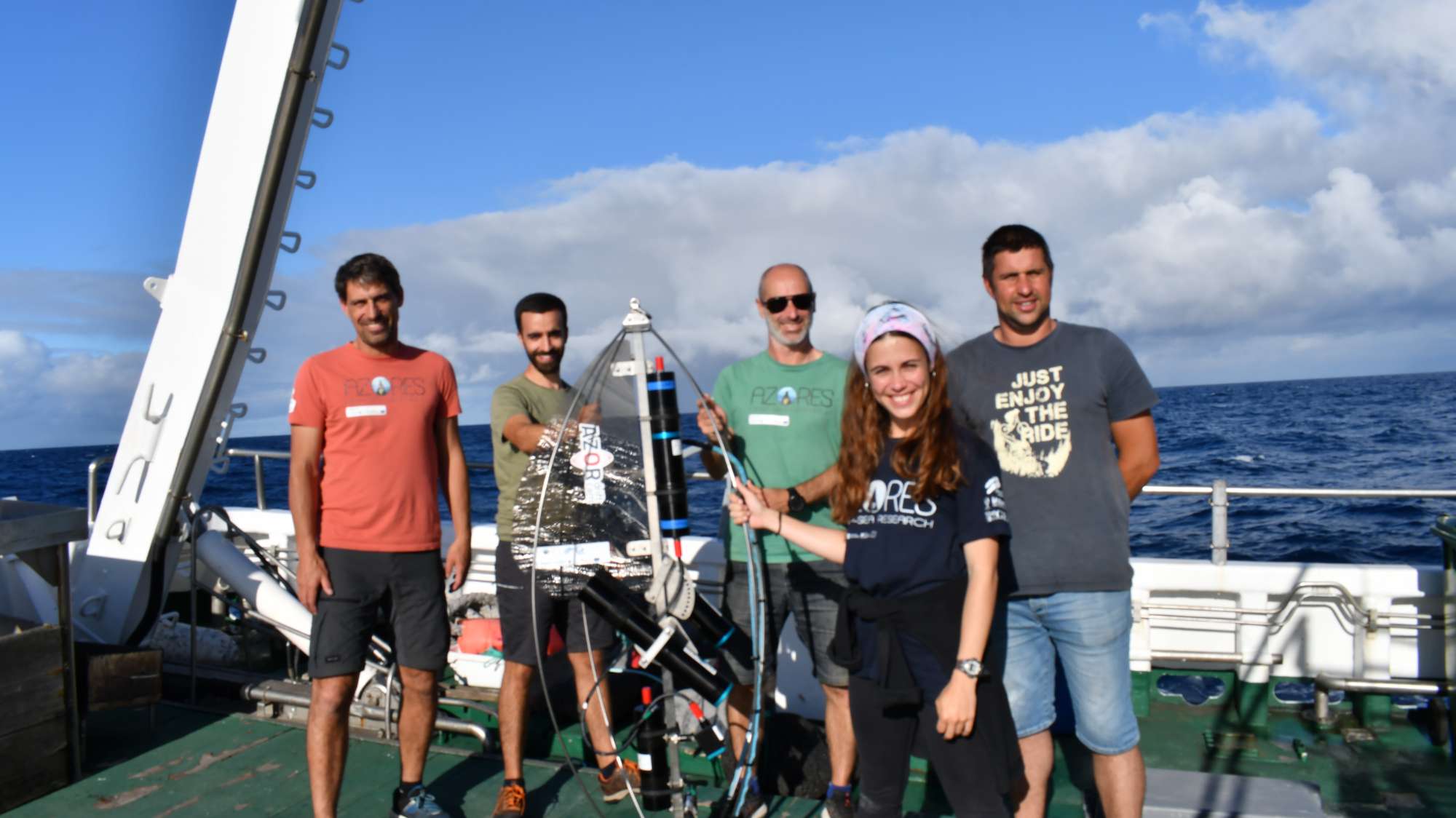
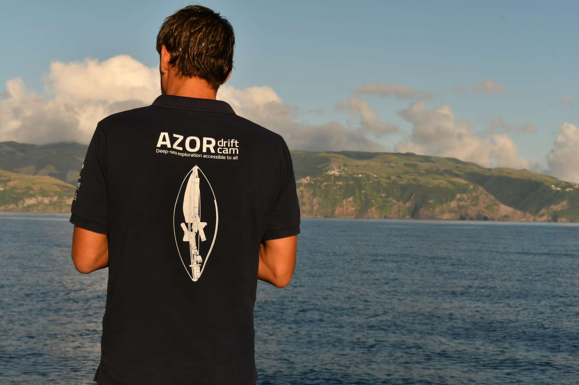
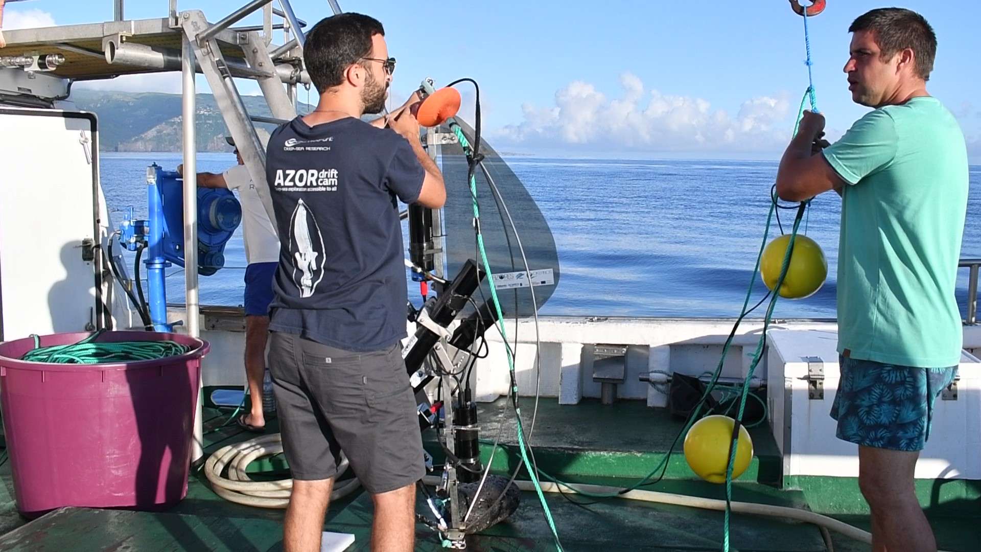
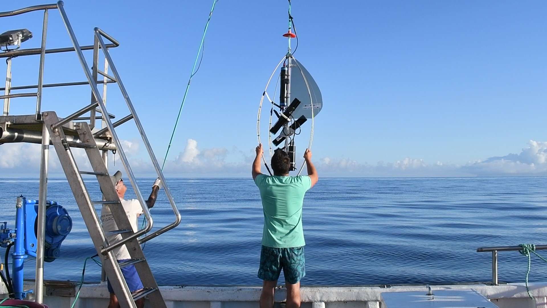
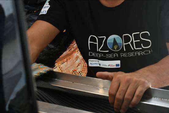
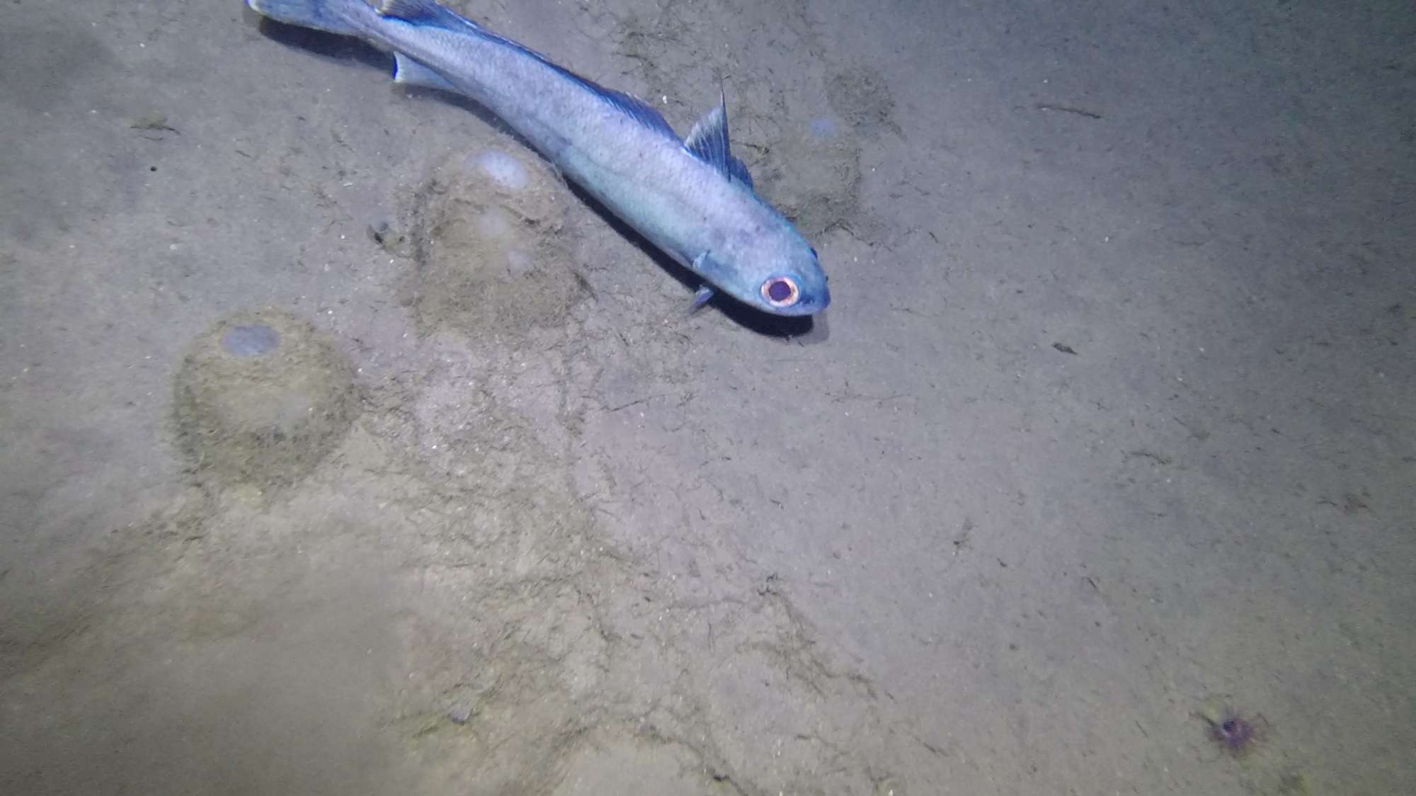
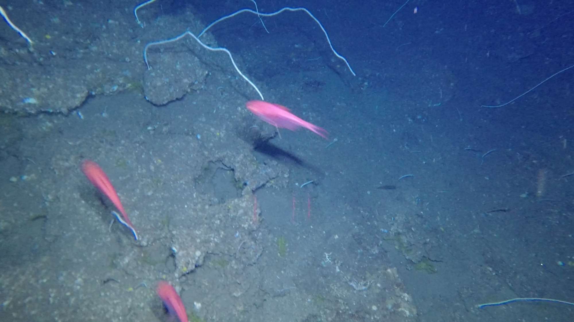
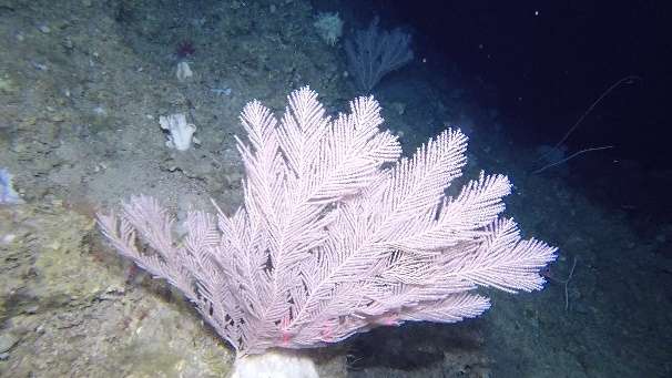
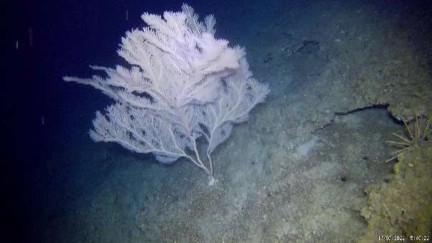
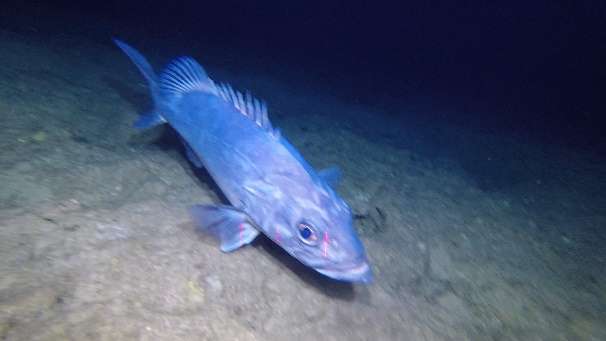
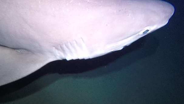
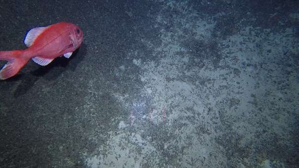
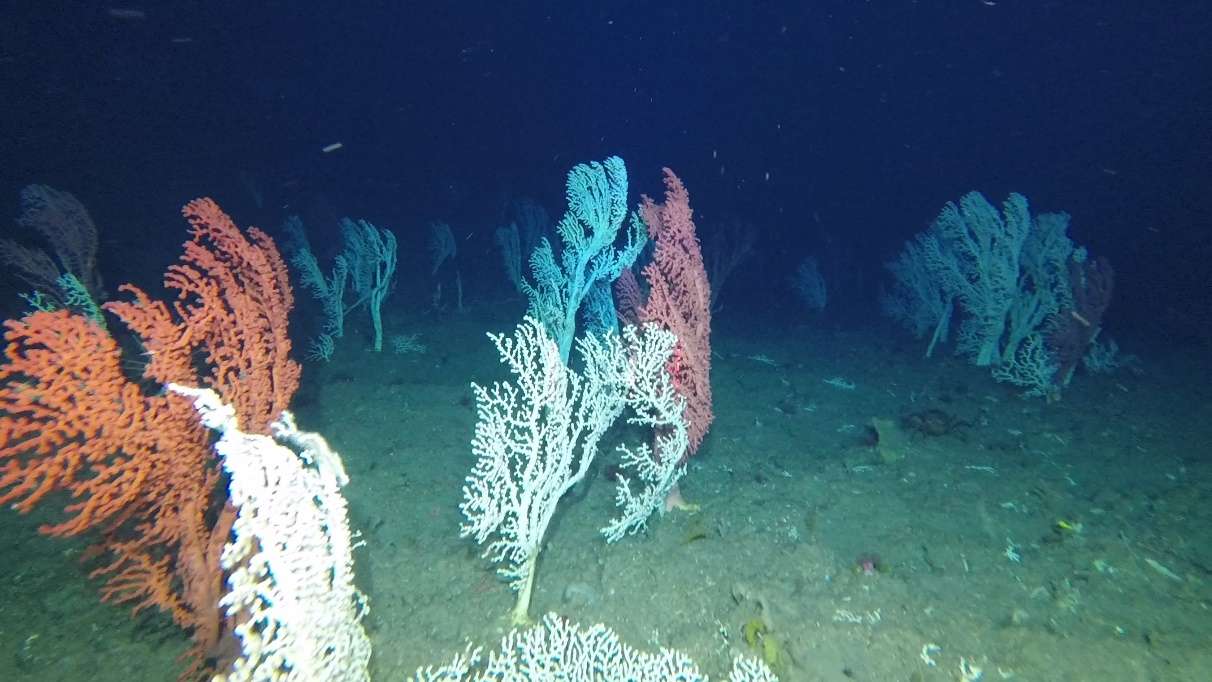
MapGES 2022 is the continuation of our long term strategy to map deep-sea biodiversity and identify Vulnerable Marine Ecosystems (VMEs) in the Azores using the Azor drift-cam system. This year, we operated from the RV Arquipelago and were lucky to finally explore some long-awaited areas such as the Diogo de Teive and Cachalote seamounts, the Flores island slopes (western Azores), but also the Girard, Maria Celeste and Formigas seamounts and the Santa Maria island slopes (eastern Azores). As in other MapGES cruises, the objectives were to (i) map benthic communities inhabiting unexplored seamounts, ridges and island slopes, (ii) identify new areas that fit the FAO Vulnerable Marine Ecosystem definition; and (iii) determine distribution patterns of deep-sea benthic biodiversity in the Azores. The results of this cruise added to the previous contributions to identify the environmental drivers that determine the spatial distribution of deep-sea benthic biodiversity in the Azores. It also provided valuable information in the context of Good Environmental Status (GES), Marine Spatial Planning (MSP) and provide new insights on how to sustainably manage deep-sea ecosystems.


Statistics
Transits
2100 km
Multibeam Bathymetry
0 km²
Filmed Seabed
71 km
Visited Areas
22
Stations
134
Dives
130
Video Footage Recorded
130 hours
Used Storage
7.1 Tb
Samples
0
No information available at this moment

Highlights
  1. During the MapGES 2022 cruise we accomplished of more than 130 underwater video transects between 190 and 1099 m depth with the Azor drift-cam, adding up to around 130 new hours of underwater video footage of seabed habitats. The presence of many lost fishing lines made our deep-sea exploration challenging. After having the Azor drift-cam caught on several lines, we managed to get free with only minor damages. These collateral fishing impacts, i.e., preventing the acquisition of deep-sea biodiversity data to inform management deserve to be better quantified.
  2. Deep-sea explorations with the Azor drift-cam confirmed that Diogo de Teive seamount may classify as a near-natural or pristine area. The Portuguese Hydrographic Institute mapped this seamount in 2019 and found that it was much shallower than previous maps showed. Because of the lack of known fishing events, we classified Diogo de Teive as a potential near-natural or pristine area. In Leg 1, we found many large and intact colonies of soft coral Callogorgia verticillata, with no signs of impacts from fishing and encountered large schools of wreckfish Polyprion americanus. More exploration may be needed, but this area should be kept in the list of priority areas for conservation in the Azores.
  3. We explored the Cachalote seamount with the Azor drift-cam, after almost 4 years of waiting. The Portuguese Hydrographic Institute also mapped this seamount back in 2018 and revealed its flat-topped structure. The benthic communities showed a clear vertical stratification with larger gardens of Narella bellissima and Narella versluysi, and of Acanella arbuscula at depths between 700 m and 900 m and gardens of Callogorgia verticillata, Viminella flagellum, among many other corals and sponges, between 500 m and 600 m depth. We also drifted over some alfonsinos, silver roughy, wreckfish, and many lost fishing lines both on the deeper dives and on the summit. Although there were some quite large Callogorgia verticillata corals, many showed signs of fishing impacts
  4. We also explored the deep-sea around Flores island, the westernmost point of the Azores and Europe but sitting on the North American Plate. We were stunned by two very dense patches of large pink and white bubble gum corals (Paragorgia cf. johnsoni) that resemble a lot of those observed in the Gigante Western Ridge. These areas are good candidates for breaking the record of the Azores' densest bubble gum coral garden. These coral gardens are still in reasonably good conditions, despite the fact that many colonies showed signs of impact and some were found lying broken on the seafloor. We were also stunned by the fauna colonizing the steep walls around Flores with large corals resembling Paramuricea and with the diverse benthic communities observed with, for example, Acanthogorgia sp., Dentomuricea cf meteor, white and yellow Viminella flagellum, Elatopathes abietina, and Leiodermatium sp.
  5. Deep-sea exploration with the Azor drift-cam of several isolated seamounts located between the islands of Pico and Santa Maria (Albatroz do Meio, Girard, Maria Celeste) for which no information regarding their benthic communities was previously available. The images recorded revealed a diverse benthic ecosystem characterized by (among several other assemblages) dense coral gardens of Narella versluysi, Narella bellissima and Candidella imbricata, aggregations of Stylasterids, large Callogorgia verticillata colonies and sponge grounds with the barrel sponge Pheronema carpenteri, as well as extensive areas with deposits of coral rubble.
  6. We completed the first visual survey of the slopes of Santa Maria island, with a total of 30 dives carried out with the Azor drift-cam at depths between 200 and 1070 m depth, covering the whole perimeter of the island. The habitats explored host rich benthic communities, with black corals of the genus Leiopathes on its deepest areas, coral gardens of Narella versluysi and Narella bellissima and sponge grounds withPheronema carpenteri at intermediate depths, and coral gardens with Viminella flagellum and Callogorgia verticillata, as well as aggregations of giant sponges of the genus Characella, in the shallowest areas explored, among several other assemblages.
  7. We explored areas below 600 m depth inside the Marine Protected Area (MPA) of Formigas seamount to complete the exploratory work performed in deeper areas during the MedWaves cruise in 2016. The dives unveiled one of the largest and densest aggregations of the primnoid coral Callogorgia verticillata ever recorded in the Azores, which was found on the northern slopes of Formigas seamount. Although the area has been protected for several years, we were surprised by the amount of lost or abandoned fishing lines observed laying over the seabed.
  8. We performed the first dives ever on Margrette seamount, the easternmost part of the Azores archipelago shallower than 1000 m depth, and hence that can be surveyed with the Azor drift-cam. Margrette seamount appeared to be a very complex area in terms of its geological morphology, with several vertical walls that complicated the exploratory work performed.
  9. Discovered dense and diverse coral gardens and sponge grounds whose presence was unknown to science and that may fit the FAO criteria to be considered Vulnerable Marine Ecosystems (VMEs).
Scientific Crew
Telmo Morato
Principal Investigator
Luís Rodrigues
Senior Scientist
Sérgio Gomes
Research Assistant
Guilherme Gonçalves
Research Assistant
Inês Carneiro
Research Assistant
Carlos Dominguez-Carrió
Senior Scientist
Manuela Ramos
Research Assistant


Collaborators
Marina Carreiro-Silva

Location of operation

Flores, Cachalote seamount (western Azores), Faial, Pico and São Jorge island slopes (central Azores), Albatroz, Girard, Maria Celeste, Santa Maria, Formigas (eastern Azores)


Stations
Settings Fullscreen
Leg Period Days at sea Vessel Departure Return
1 06/07/2022 - 23/07/2022 18 RV Arquipélago Horta Horta
2 14/08/2022 - 28/08/2022 15 RV Arquipélago Horta Horta
A total of 33 days at sea
Activities
Video survey (Azor drift-cam)


Departamento de Oceanografia e Pescas

Rua Prof. Doutor Frederico Machado, 4

9901-862 Horta, Portugal

Azores Deep-sea Research

azoresdeepsea@gmail.com

Contact us
AZORES DEEP-SEA RESEARCH © 2020-2024 Developed by Valter Medeiros © IMAR/OKEANOS-UAc